Nestled at the northern end of Similan Island No. 8, Donald Duck Bay is a sheltered, picture-perfect bay named after a duck-shaped granite rock formation. Its shallow, crystal-clear waters and gentle conditions make it one of the best easy snorkelling sites in the Similan Islands. The underwater landscape features a mix of granite boulders, pinnacles, and colourful hard and soft coral bommies, with numerous swim-throughs on the western side. By night, the bay transforms into a nocturnal wonderland, with nurse sharks, lobsters, and octopus emerging from the reef. Green turtles and hawksbill turtles are frequent visitors, often gliding curiously close to snorkellers in this protected marine sanctuary.
Donald Duck Bay
BeginnerGO
GO
It's a go.
Showing last known conditions
Wave Height 0.2 mSwell Period 7.7 sWind Speed 3.0 knPrecipitation 11 mmTidal Phase flood
Last evaluated
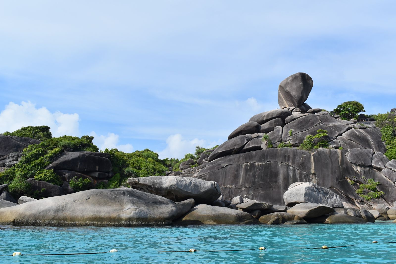
The spot
Community-maintained
Community contribution: submitted by Daniel
Know before you go
Logged by the community, confirmed by mods
Low risk: Boat traffic
Occasional boat traffic from liveaboard and day-trip vessels mooring in the bay.
Low risk: Crowded conditions
During peak season (Oct-Nov), the bay can be crowded with day-trippers and snorkellers.
Wildlife Guide
No wildlife notes for this spot yet.
Gallery
2 photos from the community
Getting in
Boat
Entry
Donald Duck Bay is located on the north-west side of Similan Island No. 8 in the Similan Islands, Thailand. Access is by liveaboard cruise boat or day-trip boat from Khao Lak or Phuket. Boats moor in the flat sheltered waters of the bay, with a mooring line near the northern pinnacles for easy entry.
Parking & facilities
No car parking available. Access is strictly by boat.
toilets
Access is typically via liveaboard or day-tour packages. National park entry fees for Similan Islands apply.
Spot Map
Community
Gallery ┬╖ 2 photos
Trust
Is this spot real, accurate, still loved?
Spots near Thailand

No nearby spots yet.
Needs verification
Quick verify
One tap helps the community keep this spot honest.
About this data
- Conditions last evaluated
- Spot data last updated
- Data sources
- Open-Meteo (marine & weather conditions), tide predictions via UTide, community contributors (descriptions, hazards, marine life).
- License
- Spot content licensed under CC BY-SA 4.0. How's the Spot is open source.
Weather & swell ┬╖ Open-Meteo marine & weather APIs Tides ┬╖ UTide harmonic analysis Sea & safety ┬╖ community reports