Denhams Beach is the most northerly of three beaches nestled in a sweeping bay on the Eurobodalla coast, just south of Batemans Bay. The tranquil left-hand side of the beach offers calm, shallow waters perfect for shore-entry snorkelling, where swimmers can explore rocky reefs, seaweed beds, and submerged rock formations teeming with nooks and crannies. This protected pocket is renowned for frequent dolphin pods cruising through the bay, making every visit a potential wildlife encounter. Part of the Batemans Marine Park, the area showcases the rich temperate marine environment of the NSW South Coast.
Denhams Beach
BeginnerMAYBE
MAYBE
Fair. Experienced snorkellers only.
Showing last known conditions
Wave Height 0.0 mSwell Period 0.0 sWind Speed 2.5 knPrecipitation 34 mmTidal Phase flood
Last evaluated
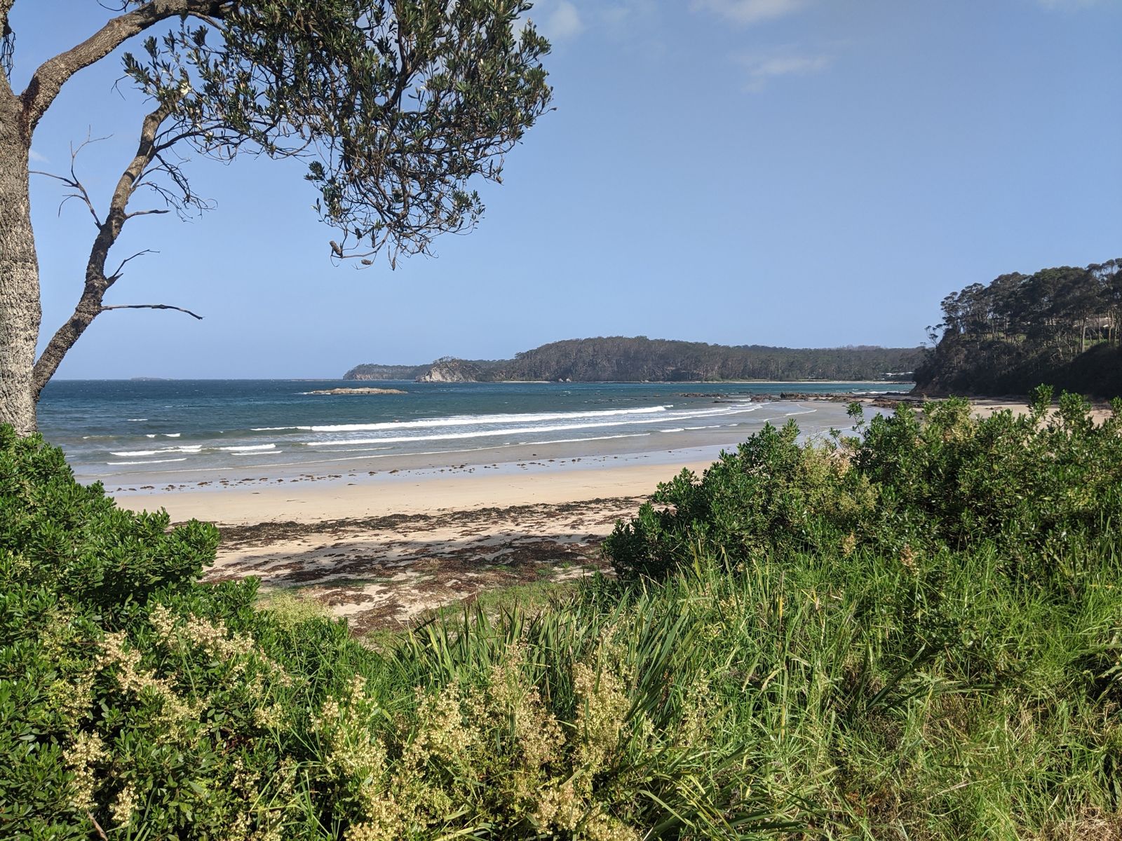 © Grahamec
The spot
Community-maintained
Community contribution: submitted by Daniel
Know before you go
Logged by the community, confirmed by mods
Moderate risk: Rip currents
Rips can form along the beach, particularly near the rocky headlands. Swim parallel to the beach to exit if caught.
Low risk: Swell conditions
Can become unsafe in easterly swells; check conditions before entering. The beach is exposed to ocean swells from the east.
Low risk: Sharp reef underfoot
Rocky reefs and submerged boulders with urchin barrens can be sharp. Snorkel booties recommended for entering over the rocks.
Wildlife Guide
No wildlife notes for this spot yet.
Gallery
3 photos from the community
Getting in
Shore entry
Entry
Located off George Bass Drive (the coastal highway). Turn onto Graydon Avenue and follow it to the beach carpark at the end. Denhams Beach is about 10 minutes south of Batemans Bay town centre.
Parking & facilities
Street parking is available along Graydon Avenue near the beach access point.
No fees required. Free public beach access.
Spot Map
Community
Gallery ┬╖ 3 photos
Trust
Is this spot real, accurate, still loved?
Spots near Victoria

No nearby spots yet.
Needs verification
Quick verify
One tap helps the community keep this spot honest.
About this data
- Conditions last evaluated
- Spot data last updated
- Data sources
- Open-Meteo (marine & weather conditions), tide predictions via UTide, community contributors (descriptions, hazards, marine life).
- License
- Spot content licensed under CC BY-SA 4.0. How's the Spot is open source.
Weather & swell ┬╖ Open-Meteo marine & weather APIs Tides ┬╖ UTide harmonic analysis Sea & safety ┬╖ community reports