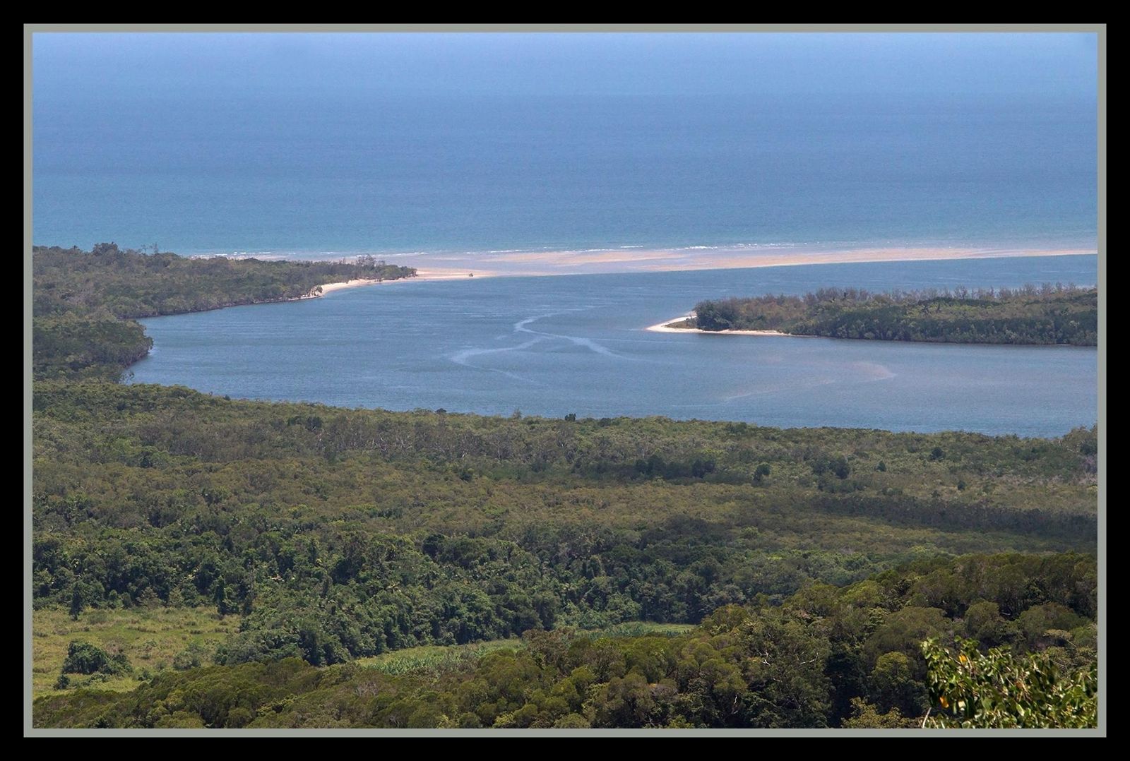
The Daintree River mouth, where the ancient Daintree Rainforest meets the Coral Sea, is a wild, estuarine confluence of murky freshwater and tidal saltwater, creating a dynamic but extremely hazardous environment. Located just south of Cape Tribulation, this is where croc-wise signage warns visitors away from swimming. While the Mount Alexandra lookout offers breathtaking views of the river snaking out across the coastline, entering the water here is strongly advised against due to the presence of estuarine crocodiles and strong tidal currents. This is not a recreational snorkeling destination — it's a powerful, untamed wilderness boundary best appreciated from the shore or a boat.
Daintree River Mouth
AdvancedGO
GO
It's a go.
Showing last known conditions
Wave Height 0.1 mSwell Period 4.0 sWind Speed 5.6 knPrecipitation 9.0 mmTidal Phase unknown
Last evaluated
DANGER: Explicit Risks Present
Daintree River Mouth has hazards marked as danger. Entering the water here means you may face serious risks to your personal safety.
- Estuarine Crocodile Presence danger
Saltwater crocodiles (Crocodylus porosus) are common throughout the Daintree River system, including the mouth. Attacks have been recorded. Never swim in these waters.
The spot
Community-maintained
Community contribution: submitted by Daniel
Know before you go
Logged by the community, confirmed by mods
High risk: Estuarine Crocodile Presence
Saltwater crocodiles (Crocodylus porosus) are common throughout the Daintree River system, including the mouth. Attacks have been recorded. Never swim in these waters.
Moderate risk: Strong Tidal Currents
The river mouth experiences strong tidal flows where freshwater meets the ocean, creating powerful rip currents and unpredictable water movement.
Moderate risk: Murky Water / Low Visibility
The Daintree River mouth is estuarine with poor visibility due to sediment and silt runoff from the rainforest, making it impossible to see submerged hazards or crocodiles.
Moderate risk: Marine Stingers (Box Jellyfish)
Box jellyfish and other dangerous marine stingers inhabit Far North Queensland coastal waters, particularly during the warmer months (November to May).
Wildlife Guide
No wildlife notes for this spot yet.
Gallery
1 photo from the community
Getting in
Shore entry
Entry
The Daintree River mouth is located at the northern end of the Daintree National Park (CYPAL), near Cape Tribulation. Access is via the Daintree River Ferry crossing on Cape Tribulation Road, then continuing north toward Mount Alexandra lookout parking area. The river mouth is visible from the lookout; direct beach access is limited and not recommended.
Parking & facilities
Car park available at the Mount Alexandra lookout area, with views overlooking the Daintree River mouth. Limited roadside parking along Cape Tribulation Road near the estuary approaches may also be available but is not formalised for swimming/snorkeling access due to extreme hazards.
Spot Map
Community
Gallery ┬╖ 1 photos
Trust
Is this spot real, accurate, still loved?
Spots near Queensland

No nearby spots yet.
Needs verification
Quick verify
One tap helps the community keep this spot honest.
About this data
- Conditions last evaluated
- Spot data last updated
- Data sources
- Open-Meteo (marine & weather conditions), tide predictions via UTide, community contributors (descriptions, hazards, marine life).
- License
- Spot content licensed under CC BY-SA 4.0. How's the Spot is open source.
Weather & swell ┬╖ Open-Meteo marine & weather APIs Tides ┬╖ UTide harmonic analysis Sea & safety ┬╖ community reports