Coffin Bay's sheltered town beaches and historic jetty offer easy-access snorkeling inside the pristine waters of Thorny Passage Marine Park on the Eyre Peninsula. The shallow, sandy-bottomed bays near the foreshore are calm and protected, with clear turquoise water perfect for beginners. The jetty itself acts as a fish-aggregating structure, drawing schools of reef fish beneath its pylons. Just a short drive west, the Coffin Bay National Park lagoon offers a more adventurous snorkel with blue gropers and other reef fish, protected from the Southern Ocean by a natural reef ledge. The town's tranquil setting, bordered by national park and oyster farms, makes it a relaxed base for underwater exploration.
Coffin Bay (Town Beaches / Jetty)
BeginnerSKIP
SKIP
Poor conditions. Stay out today.
Showing last known conditions
Wave Height 1.3 mSwell Period 11 sWind Speed 0.9 knPrecipitation 4.8 mmTidal Phase slack
Last evaluated
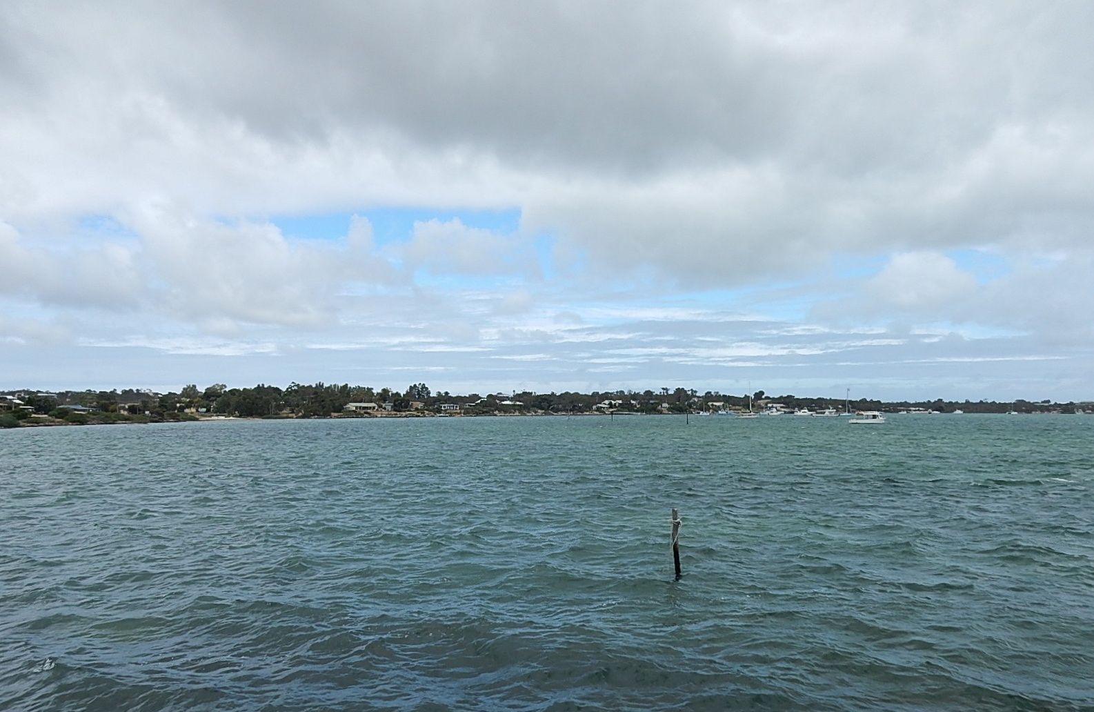 © Michael Coghlan
The spot
Community-maintained
Community contribution: submitted by Daniel
Know before you go
Logged by the community, confirmed by mods
Moderate risk: Not accessible in winter
The lagoon is protected by a reef ledge but is not accessible during winter months due to rough conditions.
Moderate risk: Winter swell closure
The lagoon is protected by a reef ledge and is not accessible during winter months (Jun-Aug) due to dangerous ocean swells.
Moderate risk: Bushfire risk / park closure
The park is closed on days of Catastrophic Fire Danger and may close on Extreme Fire Danger days, particularly during summer.
Moderate risk: Boat traffic in channel
Recreational and oyster-farming boat traffic uses the main channel; snorkelers must stay clear of boat lanes and keep near the jetty structure.
Low risk: Boat traffic near jetty
The jetty is a working structure used by fishing boats and oyster farm vessels. Snorkelers should stay clear of boat lanes and watch for approaching vessels.
Low risk: Outgoing tide current
As the bay drains through the channel, an outgoing tide can create a noticeable pull away from the jetty. Less experienced snorkelers should enter on a slack or incoming tide.
Low risk: Stinging jellyfish
Bluebottles (Portuguese man o' war) and other jellyfish can drift into the bay during warmer months, particularly summer.
Low risk: Sharp oyster shells
Oyster farming occurs in the area; broken shells on the sandy bottom near the jetty's pylons can cause cuts. Reef shoes recommended.
Low risk: Boat traffic
The town foreshore borders a working harbour with fishing boats and oyster farm vessels; stay within designated swimming areas.
Low risk: Stinger jellyfish
Warm summer months can bring occasional jellyfish into the bay system.
Low risk: Jetty traffic (fishing lines & hooks)
Fishing lines, hooks, and lures from anglers on the jetty can pose a snagging risk. Snorkel at a distance from active fishing areas.
Low risk: Shark presence
Great white and bronze whaler sharks have been sighted in the area, particularly near Golden Island where they hunt salmon schools. Exercise caution in deeper water.
Low risk: Strong surf at outer beaches
Beaches exposed to the Southern Ocean can develop strong surf and rips; the protected town beaches and jetty area are much safer.
Low risk: Lagoon access seasonal
The lagoon snorkel site within Coffin Bay National Park is not accessible in winter due to swell and conditions.
Low risk: Tidal movement around jetty
Tidal currents can push swimmers near jetty pylons; be mindful of changing tides.
Low risk: Low tide access required
The lagoon is best accessed and visible at low tide when the reef ledge is exposed and water is calmer.
Low risk: Rocky reef ledge
The reef ledge that protects the lagoon from the Southern Ocean can be sharp and slippery underfoot.
Low risk: Large shark presence (offshore)
Great white and bronze whaler sharks have been sighted working with dolphins to round up salmon schools offshore near Golden Island.
Low risk: Remote location - limited communications
Limited mobile reception in remote areas of the park.
Low risk: Boat traffic in the bay
Coffin Bay is a working oyster-farming and boating area; stay alert for vessels, especially near the channel.
Low risk: Strong afternoon sea breezes
Afternoon winds can pick up significantly in summer, creating choppy conditions and making shore exits more challenging.
Low risk: Marine stingers (bluebottles)
Bluebottles and occasional jellyfish can drift into the sheltered bay during warmer months.
Low risk: Boat traffic near oyster leases
Local fishing boats and oyster farm vessels operate in the bay. Stay aware of boat channels and avoid swimming near lease markers.
Low risk: Shifting sandbanks and tidal channels
Tidal movement can shift shallow sandbars and create deeper channels. Be mindful of changing water depths on outgoing tides.
Wildlife Guide
No wildlife notes for this spot yet.
Gallery
4 photos from the community
Getting in
Shore entry
Entry
Coffin Bay is 50 km west of Port Lincoln on the lower Eyre Peninsula, via Flinders Highway and Coffin Bay Road. The town beaches and jetty are accessed from the Esplanade in the town centre.
Parking & facilities
Free parking is available along the Esplanade and near the Coffin Bay boat ramp. A sealed carpark is located at the foreshore area.
toiletsparkingpicnic_tablesboat_ramp
No fee for town beach/jetty access. Coffin Bay National Park entry fee of $14.40 per vehicle applies if visiting the park lagoon.
Spot Map
Community
Gallery ┬╖ 4 photos
Trust
Is this spot real, accurate, still loved?
Spots near South Australia

No nearby spots yet.
Needs verification
Quick verify
One tap helps the community keep this spot honest.
About this data
- Conditions last evaluated
- Spot data last updated
- Data sources
- Open-Meteo (marine & weather conditions), tide predictions via UTide, community contributors (descriptions, hazards, marine life).
- License
- Spot content licensed under CC BY-SA 4.0. How's the Spot is open source.
Weather & swell ┬╖ Open-Meteo marine & weather APIs Tides ┬╖ UTide harmonic analysis Sea & safety ┬╖ community reports