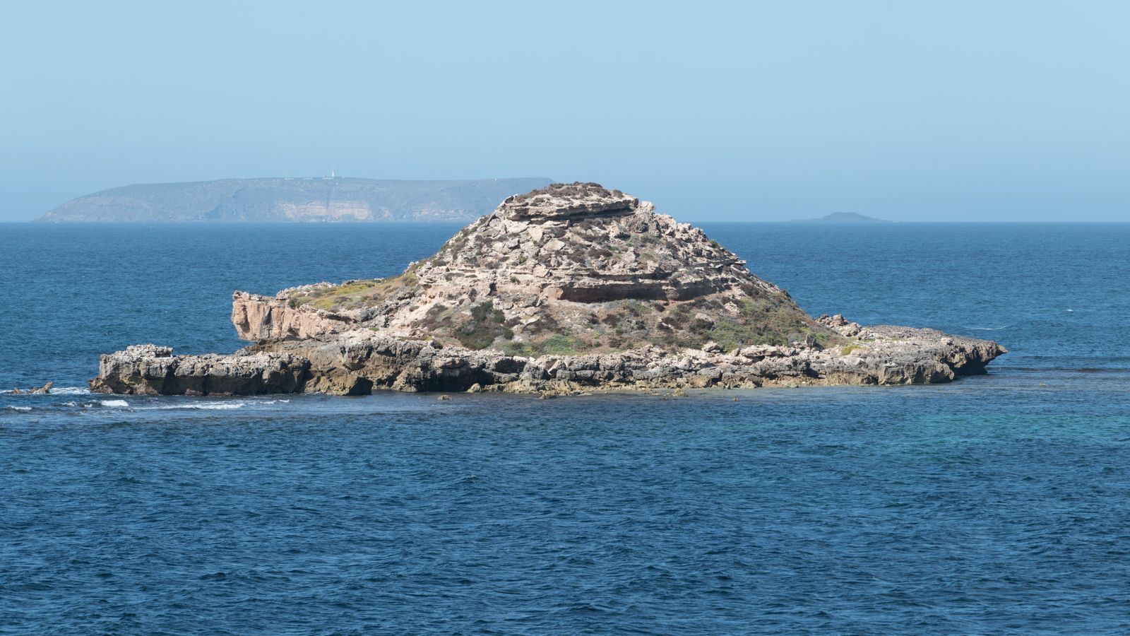
Chinaman's Hat Island is a striking conical islet just 350 metres off the southern coast of Dhilba Guuranda-Innes National Park on Yorke Peninsula. This advanced snorkel site, designated a Sanctuary Zone within the Southern Spencer Gulf Marine Park, offers an underwater playground of limestone swim-throughs, chimneys, caves, ledges and crevices in depths of 2–8 metres. At low tide, a line of reef either side of the island provides some protection from ocean swells. The site is renowned for eagle rays, southern rock lobsters, wobbegongs, Port Jackson sharks, and fiddler rays gliding through seagrass beds. Best attempted in calm conditions with light northerly winds — south winds make it unfishable.
Chinaman's Hat (Chinaman's Hat Island)
AdvancedMAYBE
MAYBE
Fair. Experienced snorkellers only.
Showing last known conditions
Wave Height 0.3 mSwell Period 10 sWind Speed 14 knPrecipitation 15 mmTidal Phase ebb
Last evaluated
DANGER: Explicit Risks Present
Chinaman's Hat (Chinaman's Hat Island) has hazards marked as danger. Entering the water here means you may face serious risks to your personal safety.
- Southerly wind hazard danger
When the wind blows from the south, the site becomes unsafe and unsnorkellable — forget entering the water under those conditions.
- Strong Currents danger
Tidal currents and rips around the island reef system can be dangerous for inexperienced swimmers.
- Southerly Wind Swell danger
If the wind is from the south, conditions become dangerously rough and the site should be avoided entirely.
The spot
Community-maintained
Community contribution: submitted by Daniel
Know before you go
Logged by the community, confirmed by mods
High risk: Southerly wind hazard
When the wind blows from the south, the site becomes unsafe and unsnorkellable — forget entering the water under those conditions.
High risk: Strong Currents
Tidal currents and rips around the island reef system can be dangerous for inexperienced swimmers.
High risk: Southerly Wind Swell
If the wind is from the south, conditions become dangerously rough and the site should be avoided entirely.
Moderate risk: Ocean currents
A steady current runs across the island from left to right, requiring snorkelers to plan entry and exit points carefully.
Moderate risk: Open ocean currents
Significant left-to-right currents run across the island; plan entry and drift accordingly. Southerly winds create dangerous conditions.
Moderate risk: Southerly winds
When wind is from the south, conditions become unsafe for snorkelling. Best avoided entirely on these days.
Moderate risk: Steep Bluff Descent
Access requires a steep 20m climb down the bluffs to reach the beach, challenging in wet conditions.
Moderate risk: Exposed Conditions
Exposed to open ocean swell and wind from Investigator Strait, conditions can change rapidly.
Moderate risk: Open Water Currents
A persistent current often runs left to right across the island. Snorkelers must plan entry/exit carefully and be comfortable drifting with the flow.
Moderate risk: Offshore current
A prevailing current runs left to right across the island. Snorkelers can drift significantly, requiring awareness at entry and exit.
Moderate risk: Tidal currents
A noticeable current runs across the island, particularly strong on the incoming or outgoing tide. Snorkelers need to plan entry/exit points and be prepared to drift.
Moderate risk: Open water swell exposure
Exposed open-water swim with no shelter from ocean swells. Reef provides some protection only at low tide.
Moderate risk: Unfavourable wind conditions (southerly)
Southerly winds create dangerously rough conditions. Best snorkeled in light or northerly winds only.
Moderate risk: Surge around reef ledges
Significant surge can develop around the rocky ledges and swim-throughs even in moderate swell, increasing risk of being pushed against rocks.
Low risk: Open water exposure
This is an exposed open-water snorkel site with no sheltered bay, making conditions highly dependent on wind direction.
Low risk: Cold water temperatures
Water temperatures range 17–22°C year-round, with winter temps posing a risk of cold shock without adequate wetsuit protection.
Low risk: Cold water temperature
Water temperatures range from 17–22°C (62–72°F); cold shock and hypothermia risk without adequate wetsuit protection.
Low risk: Exposed open water
The snorkel site is in open water with no sheltered enclosure; swells can build quickly with changing wind conditions.
Low risk: Rocky shore entry
Entry is via a beach with small steps; low tide can expose sharp reef edges. Care needed when donning fins.
Low risk: Remote Location
Located within Innes National Park with limited mobile reception and distant emergency services.
Low risk: Variable visibility
Afternoon sun, swell, and currents can significantly reduce visibility. Best conditions occur with light northerly winds and low tide.
Wildlife Guide
No wildlife notes for this spot yet.
Gallery
2 photos from the community
Getting in
Shore entry
Entry
Located in Dhilba Guuranda-Innes National Park at the southern tip of Yorke Peninsula, 290 km from Adelaide. From the National Park Visitor Centre, follow the main road through the park for approx. 3.5 km past Stenhouse Bay and look for signs to the Chinaman's Hat carpark on the right. A short walk with steps leads down to the beach entrance.
Parking & facilities
Dedicated Chinaman's Hat carpark on the right-hand side of the road, with a short walking track and steps down to the beach.
parking
A $14.40 vehicle entry fee applies to enter Dhilba Guuranda-Innes National Park. Guided snorkel tours are available through Experience Marine Sanctuaries (cost includes gear hire).
Spot Map
Community
Gallery ┬╖ 2 photos
Trust
Is this spot real, accurate, still loved?
Spots near South Australia

No nearby spots yet.
Needs verification
Quick verify
One tap helps the community keep this spot honest.
About this data
- Conditions last evaluated
- Spot data last updated
- Data sources
- Open-Meteo (marine & weather conditions), tide predictions via UTide, community contributors (descriptions, hazards, marine life).
- License
- Spot content licensed under CC BY-SA 4.0. How's the Spot is open source.
Weather & swell ┬╖ Open-Meteo marine & weather APIs Tides ┬╖ UTide harmonic analysis Sea & safety ┬╖ community reports