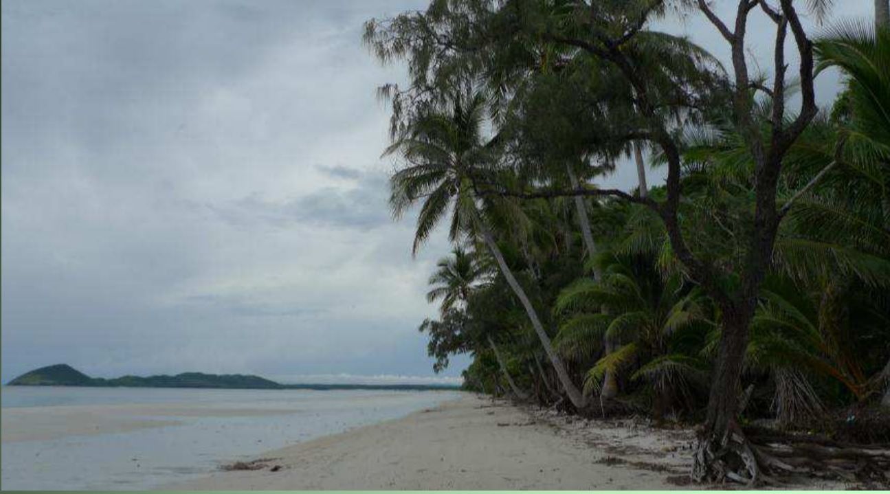
Chilli Beach is a stunning coconut-fringed stretch of white quartz sand on Cape York's eastern coast, nestled within Kutini-Payamu (Iron Range) National Park between Cape Griffith and Cape Weymouth. The coarse-grained sand, sourced from ancient granite hills ~285 million years old, forms a sweeping beach overlooking Restoration Island. This remote tropical paradise offers excellent beachcombing (including Nautilus shells), fishing in Great Barrier Reef Marine Park waters, and world-class birdwatching with Palm Cockatoos, Papuan Frogmouths, and more. The extensive dune system is lined with coconut palms, beach almonds, and calophyllum trees. Camping behind the dunes provides shelter from the persistent tradewinds that blow from February through November.
Chilli Beach
It's a go.
Showing last known conditions
Last evaluated
 © Unidentified
DANGER: Explicit Risks Present
Chilli Beach has hazards marked as danger. Entering the water here means you may face serious risks to your personal safety.
- Estuarine Crocodiles danger
Estuarine crocodiles inhabit the coastal waters, creeks, and swamps of Iron Range. Active year-round.
- Saltwater crocodiles danger
Saltwater crocodiles are present in the waters and nearby creeks around Alau Beach. Swimming in the ocean is strongly discouraged. Crocodile risk is year-round in tropical north Queensland.
- Crocodile hazard in creek danger
The nearby creek at the campground is scenic but known to contain crocodiles. Do not swim or wade in freshwater creeks in the area.
The spot
Community-maintained
Community contribution: submitted by Daniel
Know before you go
Logged by the community, confirmed by mods
High risk: Estuarine Crocodiles
Estuarine crocodiles inhabit the coastal waters, creeks, and swamps of Iron Range. Active year-round.
High risk: Saltwater crocodiles
Saltwater crocodiles are present in the waters and nearby creeks around Alau Beach. Swimming in the ocean is strongly discouraged. Crocodile risk is year-round in tropical north Queensland.
High risk: Crocodile hazard in creek
The nearby creek at the campground is scenic but known to contain crocodiles. Do not swim or wade in freshwater creeks in the area.
Moderate risk: Tradewind Swell & Wind Chop
Strong and persistent south-easterly tradewinds blow from February to November, creating challenging sea conditions, choppy water, and strong currents.
Moderate risk: Remote Location
The beach is in a remote area of Cape York accessible only by 4WD. No mobile reception, limited services, and nearest help is in Portland Roads (15 min drive) or Lockhart River.
Moderate risk: Marine Stingers
Box jellyfish and other marine stingers may be present in tropical waters, particularly during the wet season (November to May).
Moderate risk: Tidal currents near reef
Strong tidal currents can occur around the reef 200 m offshore. Snorkelers should be aware of tidal flow and avoid being swept out to sea.
Low risk: Unpatrolled Beach
No lifeguards or patrols. Swimmers and snorkelers are entirely self-reliant.
Low risk: Boil water advisory
Boil water notice has been in effect for the Cape York region since December 2022. Tap water requires boiling before drinking.
Low risk: Wild horses
Wild and semi-wild horses roam the campground and beach area. They can be aggressive if fed and leave droppings; watch your step at night.
Wildlife Guide
No wildlife notes for this spot yet.
Gallery
2 photos from the community
Getting in
Accessible by 4WD only. From the south via the Peninsula Developmental Road, or from the north via the challenging Frenchmans Track. The camping area is about a 2.5-hour drive from the development road. Portland Roads is 15 minutes away.
Parking available at the camping area day-use zone and near campsites. Suitable for campervans and caravans at designated sites behind the dunes.
Spot Map
Community
Trust
Is this spot real, accurate, still loved?
Spots near Queensland

No nearby spots yet.
Quick verify
One tap helps the community keep this spot honest.
About this data
- Conditions last evaluated
- Spot data last updated
- Data sources
- Open-Meteo (marine & weather conditions), tide predictions via UTide, community contributors (descriptions, hazards, marine life).
- License
- Spot content licensed under CC BY-SA 4.0. How's the Spot is open source.