Castle Rock Bay, near Dunsborough in Western Australia's Southwest Capes region, is a sheltered snorkeling spot defined by the rocky granite outcrop of Castle Rock. The bay offers calm, protected waters along the Cape Naturaliste coastline, with a sandy entry and shallow reef areas to explore just off shore. Its positioning within Geographe Bay provides excellent visibility and gentle conditions, making it a peaceful alternative to the more exposed beaches on the Indian Ocean side. The granite boulders and seagrass patches host a variety of small fish and marine life typical of the Leeuwin-Naturaliste region.
Castle Rock Bay / Castle Rock
BeginnerGO
GO
It's a go.
Showing last known conditions
Wave Height 0.3 mSwell Period 11 sWind Speed 0.5 knPrecipitation 1.1 mmTidal Phase ebb
Last evaluated
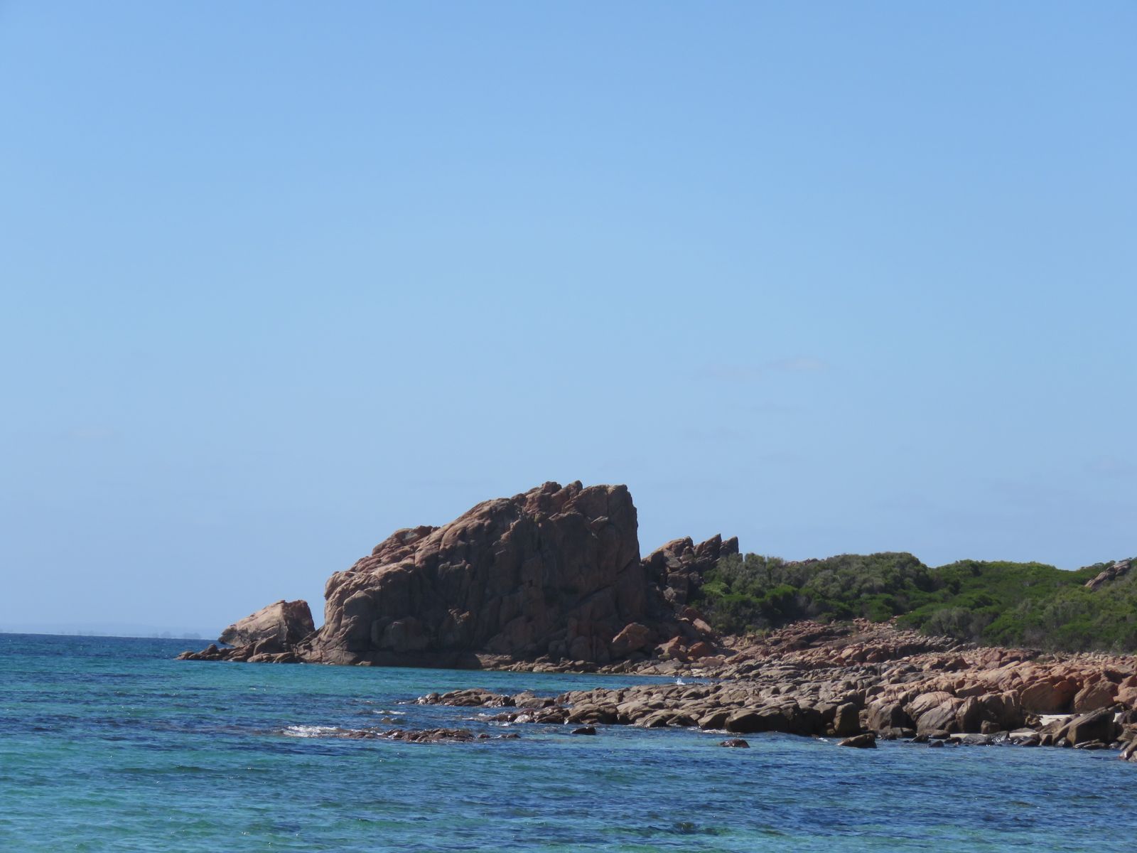 © Calistemon
The spot
Community-maintained
Community contribution: submitted by Daniel
Know before you go
Logged by the community, confirmed by mods
Low risk: Limited Facilities
Remote beach setting with minimal amenities; bring your own water and supplies.
Low risk: Wind Exposure
Afternoon sea breezes can create choppy surface conditions, reducing visibility.
Low risk: Marine stingers (box jellyfish)
Marine stingers may be present in warmer months; stinger suits recommended during summer.
Wildlife Guide
No wildlife notes for this spot yet.
Gallery
4 photos from the community
Getting in
Shore entry
Entry
Access via Castle Rock Road off Caves Road, Dunsborough. Follow Castle Rock Road to its end near the coast. The bay is located within the Ngari Capes Marine Park area, south of Dunsborough town centre.
Parking & facilities
Limited roadside parking available near the end of Castle Rock Road.
No fees required.
Spot Map
Community
Gallery ┬╖ 4 photos
Trust
Is this spot real, accurate, still loved?
Spots near Western Australia

No nearby spots yet.
Needs verification
Quick verify
One tap helps the community keep this spot honest.
About this data
- Conditions last evaluated
- Spot data last updated
- Data sources
- Open-Meteo (marine & weather conditions), tide predictions via UTide, community contributors (descriptions, hazards, marine life).
- License
- Spot content licensed under CC BY-SA 4.0. How's the Spot is open source.
Weather & swell ┬╖ Open-Meteo marine & weather APIs Tides ┬╖ UTide harmonic analysis Sea & safety ┬╖ community reports