Cape Schanck sits at the wild southern tip of the Mornington Peninsula, where Bass Strait swells have carved a spectacular underwater landscape of caves, tunnels, gullies and canyons into the limestone reef. Part of the Great Southern Reef, this exposed shore-dive site offers temperate-water snorkeling over heavily eroded rock platforms teeming with wrasse, parrotfish, abalone and rays. The dramatic volcanic backdrop of Pulpit Rock and the Devils Desk frames the entry point via a wooden staircase from the lighthouse reserve. Conditions are fickle — only safe after days of northerly winds and low swell — making this a pristine but challenging spot for experienced snorkelers seeking a wild, uncrowded ocean experience.
Cape Schanck (shore dive / snorkel)
AdvancedSKIP
SKIP
Poor conditions. Stay out today.
Showing last known conditions
Wave Height 0.8 mSwell Period 12 sWind Speed 11 knPrecipitation 32 mmTidal Phase flood
Last evaluated
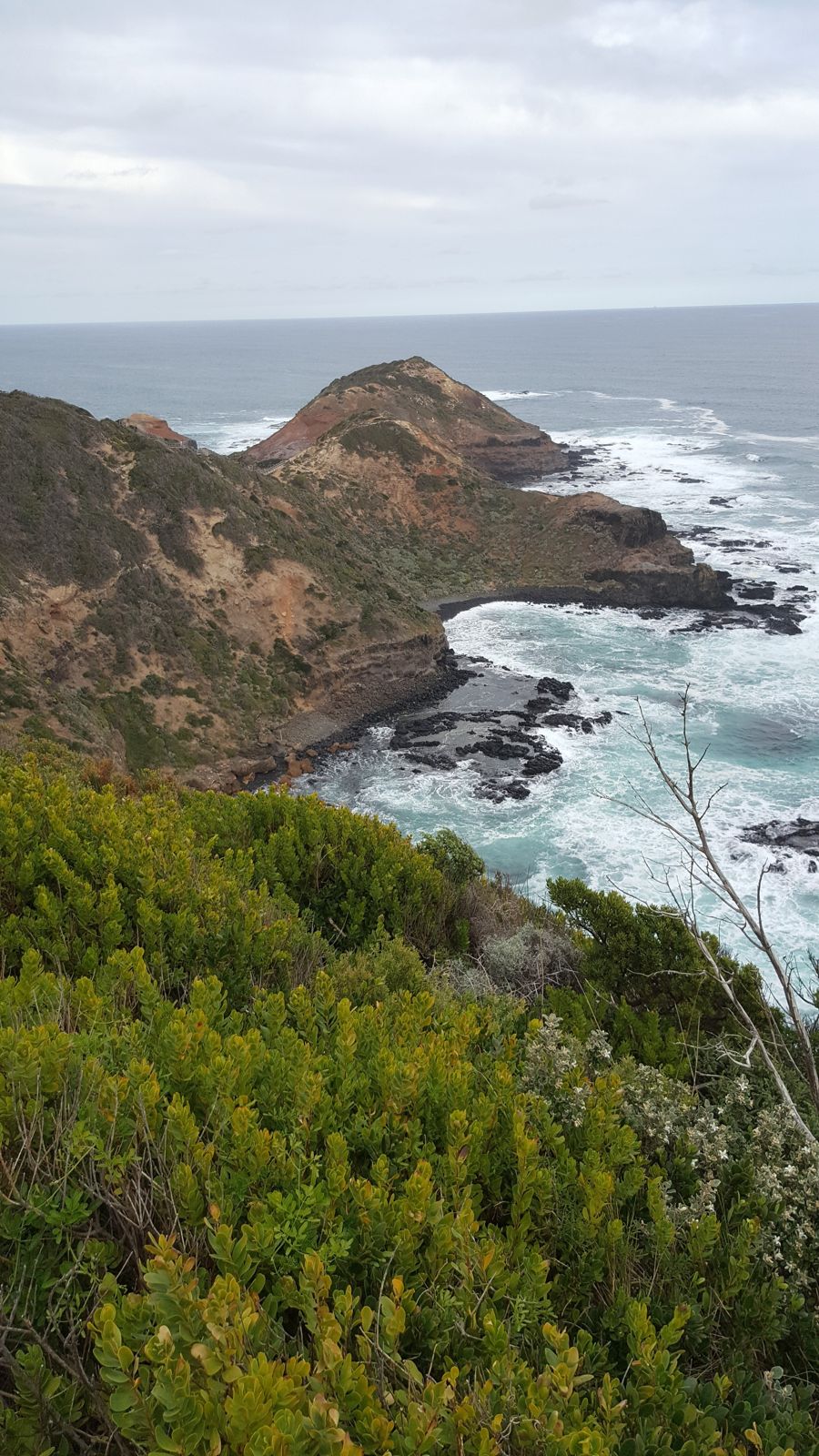 © Mgnhgh
DANGER: Explicit Risks Present
Cape Schanck (shore dive / snorkel) has hazards marked as danger. Entering the water here means you may face serious risks to your personal safety.
- Strong Rips and Currents danger
Powerful rip currents and tidal surges common on the Bass Strait side, especially near The Rip. Several drownings have occurred. Requires expert local knowledge.
- Large Swells and Surf danger
Unpredictable ocean swells and large waves can appear suddenly even on calm days. Only safe after several days of northerly winds or no wind.
- Powerful rip currents danger
All back beach sites are rip-prone. The shallow reef creates considerable surge even on calm days. Many swimmers and divers have drowned here.
The spot
Community-maintained
Community contribution: submitted by Daniel
Know before you go
Logged by the community, confirmed by mods
High risk: Strong Rips and Currents
Powerful rip currents and tidal surges common on the Bass Strait side, especially near The Rip. Several drownings have occurred. Requires expert local knowledge.
High risk: Large Swells and Surf
Unpredictable ocean swells and large waves can appear suddenly even on calm days. Only safe after several days of northerly winds or no wind.
High risk: Powerful rip currents
All back beach sites are rip-prone. The shallow reef creates considerable surge even on calm days. Many swimmers and divers have drowned here.
Moderate risk: Slippery Rock Platforms
Entry and exit via limestone rock platforms exposed at low tide. Platforms are slippery and separated by gullies. Exit points can disappear as tide rises.
Moderate risk: Large Tidal Range
Tidal range of several metres. Low tide is essential for safe entry/exit. Snorkelers must time dives around low tide.
Moderate risk: Tidal range & timing
Tidal range of several metres. Entry/exit rock platforms are only exposed at low tide or 1–2 hours before low tide.
Moderate risk: Slippery limestone platforms
The entry and exit rock platforms are separated by gullies. Large unexpected waves can wash across the rocks.
Moderate risk: Remote & unpatrolled beaches
No lifeguards, poor mobile reception, limited access. Closest patrolled beach is Gunnamatta (summer only).
Wildlife Guide
No wildlife notes for this spot yet.
Gallery
3 photos from the community
Getting in
Shore entry
Entry
From Melbourne, take the M1 towards the Mornington Peninsula. Exit onto the Mornington Peninsula Freeway (M11) and continue south to its end at Boneo Road. Follow signs towards Cape Schanck Lighthouse Reserve. The snorkel entry is via the wooden staircase and boardwalk from the main carpark down to the rock platform at the cape.
Parking & facilities
Large carpark at Cape Schanck Lighthouse Reserve. Fills quickly on weekends and peak holiday periods.
toiletsparkingpicnic_tables
Free entry to the reserve and carpark. No drinking water available.
Spot Map
Community
Gallery ┬╖ 3 photos
Trust
Is this spot real, accurate, still loved?
Spots near Victoria

No nearby spots yet.
Needs verification
Quick verify
One tap helps the community keep this spot honest.
About this data
- Conditions last evaluated
- Spot data last updated
- Data sources
- Open-Meteo (marine & weather conditions), tide predictions via UTide, community contributors (descriptions, hazards, marine life).
- License
- Spot content licensed under CC BY-SA 4.0. How's the Spot is open source.
Weather & swell ┬╖ Open-Meteo marine & weather APIs Tides ┬╖ UTide harmonic analysis Sea & safety ┬╖ community reports