Cape Northumberland marks the southernmost point of South Australia, where dramatic limestone cliffs meet the Southern Ocean. Just west of Port MacDonnell, this rugged headland offers sheltered swimming coves like Posties Beach, Finger Point, and the aptly named Snorkelling Bay, where lobstering is a local tradition. The crystal-clear waters over sandstone reefs and gutters teem with temperate marine life, making it a rewarding shore-entry snorkel spot for those keen to explore the wild limestone coast's underwater terrain.
Cape Northumberland
IntermediateSKIP
SKIP
Poor conditions. Stay out today.
Showing last known conditions
Wave Height 1.8 mSwell Period 11 sWind Speed 12 knPrecipitation 7.9 mmTidal Phase slack
Last evaluated
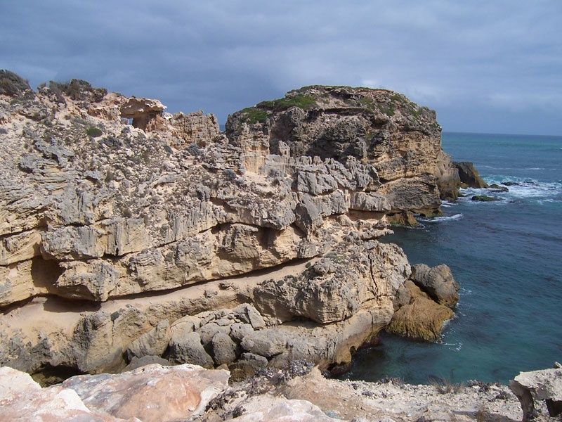 © Ethanwhite07
The spot
Community-maintained
Community contribution: submitted by Daniel
Know before you go
Logged by the community, confirmed by mods
Moderate risk: Southern Ocean Swell
Exposed to powerful Southern Ocean swells that can create strong surge and dumping waves near the limestone cliffs, especially on windy days.
Moderate risk: Rip Currents
Unpredictable rip currents form between the rocky headlands and gutters; can sweep swimmers away from sheltered coves.
Low risk: Sharp Limestone Reef
The sandstone/limestone reef platform has sharp edges and crevices that can cause cuts; reef shoes recommended.
Wildlife Guide
No wildlife notes for this spot yet.
Gallery
4 photos from the community
Getting in
Shore entry
Entry
From Port MacDonnell, head west along the coast road for approximately 5 km. The Cape Northumberland lookout and access track leads down to Posties Beach and the sheltered coves. The turn-off is signposted just past the Port MacDonnell foreshore.
Parking & facilities
Limited gravel parking available near the Cape Northumberland lookout area. Additional roadside parking possible along the access road.
parking
Free access
Spot Map
Community
Gallery ┬╖ 4 photos
Trust
Is this spot real, accurate, still loved?
Spots near Victoria

No nearby spots yet.
Needs verification
Quick verify
One tap helps the community keep this spot honest.
About this data
- Conditions last evaluated
- Spot data last updated
- Data sources
- Open-Meteo (marine & weather conditions), tide predictions via UTide, community contributors (descriptions, hazards, marine life).
- License
- Spot content licensed under CC BY-SA 4.0. How's the Spot is open source.
Weather & swell ┬╖ Open-Meteo marine & weather APIs Tides ┬╖ UTide harmonic analysis Sea & safety ┬╖ community reports