Canal Rocks is a dramatic granite headland on the Leeuwin-Naturaliste coast, carved by the Indian Ocean into a series of surge channels, crevasses, and turquoise pools. Located just south-west of Yallingup, this striking formation offers adventurous snorkelers the chance to explore sheltered bays and channel edges where clear, cooler waters host vibrant marine life. A raised boardwalk and footbridge lead out over the canals, providing jaw-dropping views of waves exploding against the ancient granite. The contrast of white foam, deep blue water, and weathered pink-grey rock is unforgettable — best visited September to April when seas are calmest.
Canal Rocks
IntermediateSKIP
SKIP
Poor conditions. Stay out today.
Showing last known conditions
Wave Height 2.0 mSwell Period 12 sWind Speed 0.9 knPrecipitation 1.1 mmTidal Phase ebb
Last evaluated
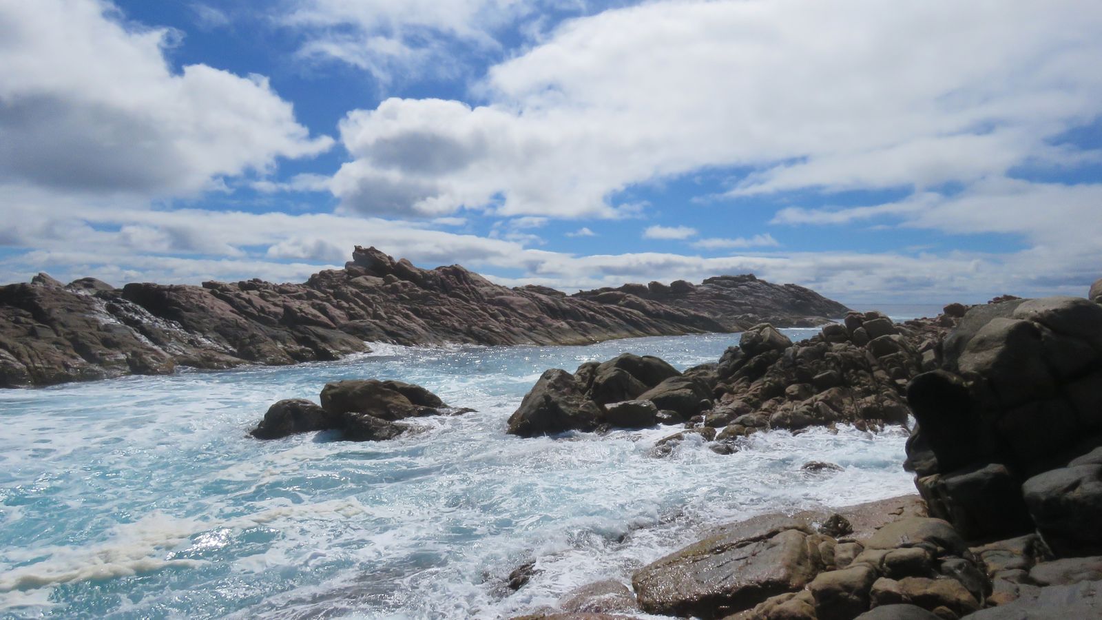 © Calistemon
DANGER: Explicit Risks Present
Canal Rocks has hazards marked as danger. Entering the water here means you may face serious risks to your personal safety.
- King Waves and Surges danger
Unpredictable large waves and surging swells can wash across the rocks without warning, especially in winter.
The spot
Community-maintained
Community contribution: submitted by Daniel
Know before you go
Logged by the community, confirmed by mods
High risk: King Waves and Surges
Unpredictable large waves and surging swells can wash across the rocks without warning, especially in winter.
Moderate risk: Strong Rips and Currents
Powerful rip currents sweep through the granite channels, posing a serious risk to swimmers and snorkelers.
Moderate risk: Exposed Ocean Conditions
The site is directly exposed to the Indian Ocean with no natural barrier, making conditions change rapidly.
Low risk: Slippery Rocks
The granite surface is often wet and slippery, increasing the risk of falls.
Wildlife Guide
No wildlife notes for this spot yet.
Gallery
3 photos from the community
Getting in
Shore entry
Entry
Located just south-west of Yallingup, WA. Turn off Caves Road onto Canal Rocks Road and follow to the large car park at the end.
Parking & facilities
Large car park with ample space for cars and boat trailers.
toiletsparkingboat_ramp
No entry fee. Located within Leeuwin-Naturaliste National Park (park fees may apply).
Spot Map
Community
Gallery ┬╖ 3 photos
Trust
Is this spot real, accurate, still loved?
Spots near Western Australia

No nearby spots yet.
Needs verification
Quick verify
One tap helps the community keep this spot honest.
About this data
- Conditions last evaluated
- Spot data last updated
- Data sources
- Open-Meteo (marine & weather conditions), tide predictions via UTide, community contributors (descriptions, hazards, marine life).
- License
- Spot content licensed under CC BY-SA 4.0. How's the Spot is open source.
Weather & swell ┬╖ Open-Meteo marine & weather APIs Tides ┬╖ UTide harmonic analysis Sea & safety ┬╖ community reports