Camel Rock is a spectacular 470-million-year-old folded turbidite rock formation rising from the sand at Camel Rock Surf Beach, just north of Bermagui on the NSW Sapphire Coast. The camel-shaped outcrop sits just off the shore and is best explored at low tide when you can walk right up to its base, examine the ancient sedimentary layers, and peer into small rock pools. The beach is patrolled in summer, making it an excellent and safe spot for snorkelling in the protected inshore waters. A wheelchair-accessible viewing platform offers panoramic ocean views, while the beach itself provides easy shore-entry snorkelling amid a dramatic geological backdrop.
Camel Rock, Bermagui
BeginnerGO
GO
It's a go.
Showing last known conditions
Wave Height 0.4 mSwell Period 6.8 sWind Speed 0.7 knPrecipitation 14 mmTidal Phase slack
Last evaluated
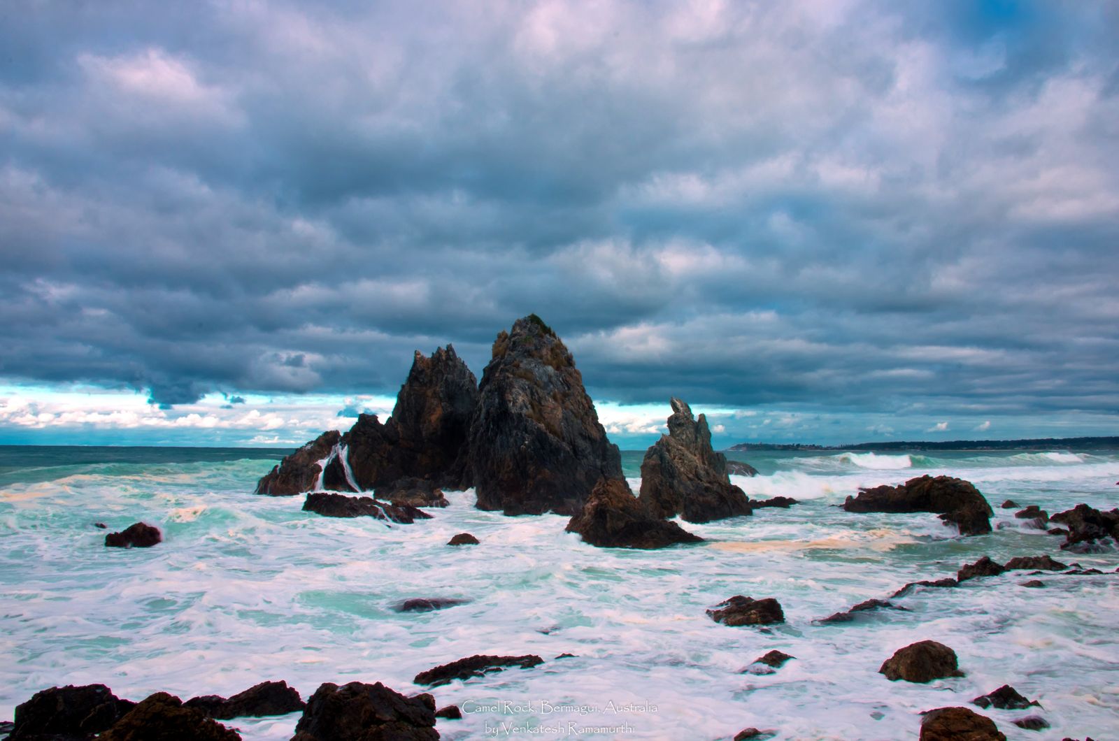 © Vrweare
The spot
Community-maintained
Community contribution: submitted by Daniel
Know before you go
Logged by the community, confirmed by mods
Moderate risk: Surf and Rip Currents
As a surf beach, Camel Rock can experience strong rips and shore breaks, especially on windy or swell-heavy days.
Moderate risk: Swell and surf conditions
Camel Rock is a popular surf beach, and waves can be powerful, particularly on the open beach front. Snorkellers should stick to the sheltered areas near the rocks and headland at Murunna Point.
Low risk: High tide submergence
At high tide, the base of Camel Rock is submerged, limiting access to the rock formation itself. Plan snorkelling for low tide.
Low risk: Beach rips and currents
Exposed beach with occasional rips. The beach is patrolled during summer months for safety.
Low risk: Wind chop (summer NE sea breeze)
Summer north-easterly sea breezes can create choppy surface conditions.
Low risk: Rocky Reef Hazards
Sharp rocks and reef shelves near the camel rock formation and headlands can cause cuts or injury when waves push swimmers onto them.
Low risk: Changing Tides
Tidal changes can affect water depth around rock pools and the offshore rock formation, potentially stranding explorers on exposed rocks at low tide.
Low risk: Outgoing tide current
The area near the Murunna Point headland and Camel Rock can develop tidal movement as the tide falls, potentially pulling snorkellers away from the shore.
Low risk: Rocky terrain at low tide
Sharp rocks and uneven reef platforms are exposed at low tide, requiring sturdy footwear and careful footing when accessing snorkelling entry points.
Low risk: Surf conditions
Can experience strong waves and rips, particularly on windy days or during southerly swells. Best on calm, low-swell days.
Low risk: Rocky reef near shore
The Camel Rock formation and surrounding reef platforms have sharp edges and barnacles. Wear reef shoes and be cautious at low tide.
Wildlife Guide
No wildlife notes for this spot yet.
Gallery
1 photo from the community
Getting in
Shore entry
Entry
Drive to Wallaga Lake Road (unsealed dirt road, but flat and accessible by 2WD) just north of Bermagui on the NSW South Coast. The Camel Rock Beach car park is at the northern end of Wallaga Lake Road. No direct public transport — hiring a car is recommended.
Parking & facilities
Spacious parking area at the northern end of Wallaga Lake Road (Camel Rock Beach Car Park). Short 20-30 m flat trail from car park to viewing platform, wheelchair accessible.
parkingtoiletspicnic_tables
Free entry. No fees required.
Spot Map
Community
Gallery ┬╖ 1 photos
Trust
Is this spot real, accurate, still loved?
Spots near Victoria

No nearby spots yet.
Needs verification
Quick verify
One tap helps the community keep this spot honest.
About this data
- Conditions last evaluated
- Spot data last updated
- Data sources
- Open-Meteo (marine & weather conditions), tide predictions via UTide, community contributors (descriptions, hazards, marine life).
- License
- Spot content licensed under CC BY-SA 4.0. How's the Spot is open source.
Weather & swell ┬╖ Open-Meteo marine & weather APIs Tides ┬╖ UTide harmonic analysis Sea & safety ┬╖ community reports