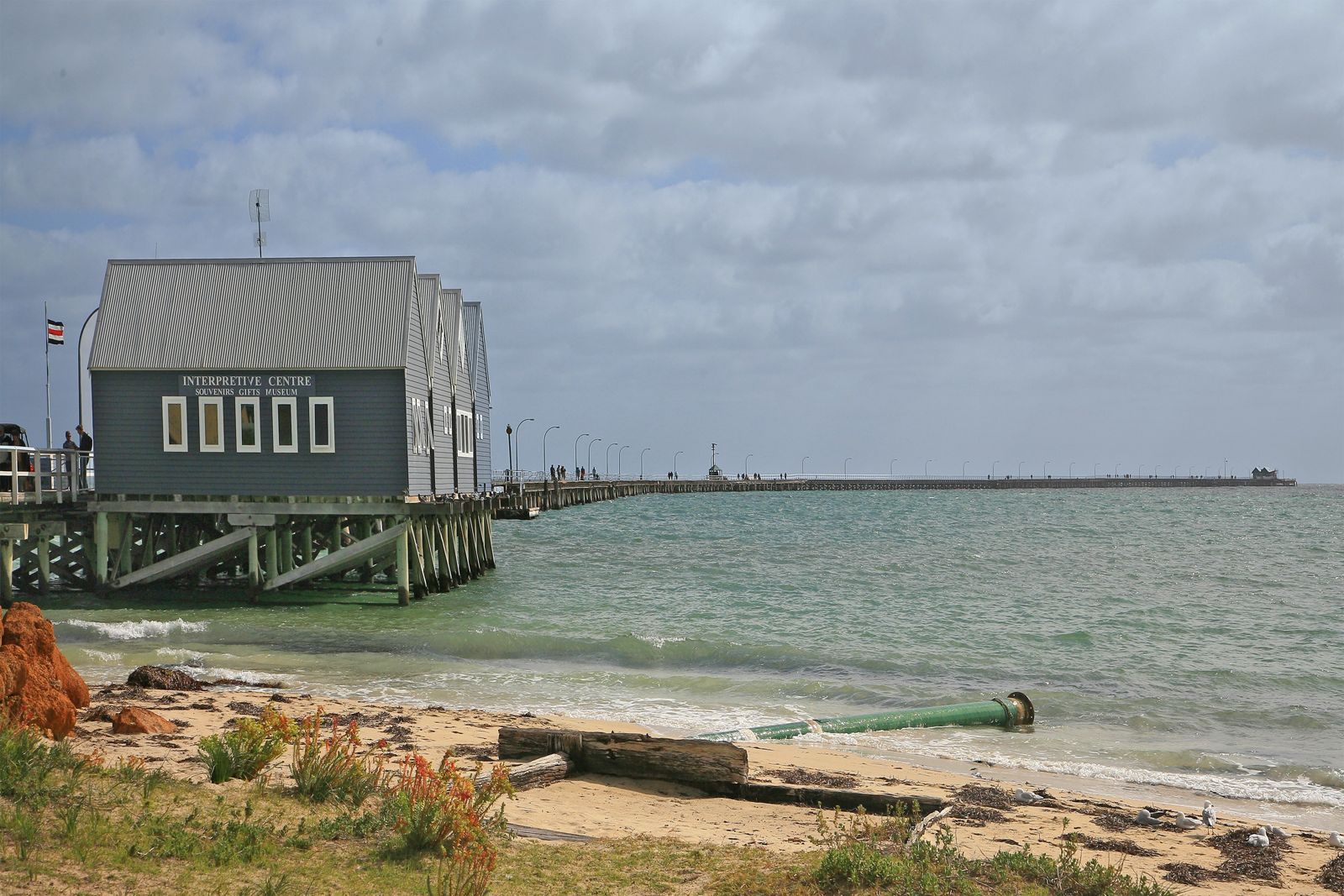
Extending 1.8 km into the calm, protected waters of Geographe Bay, the heritage-listed Busselton Jetty is the longest timber-piled jetty in the Southern Hemisphere. Snorkelers explore a world of colour wrapped around 160-year-old pylons encrusted with soft corals and sponges, plus an incredible Underwater Sculpture Park (installed 2023) featuring 13 large-scale artworks — including a 7-metre stingray, a shipwreck, a lighthouse, and a mermaid — that double as artificial reefs. Schools of yellowfin whiting, herring, bream, Old Wives, butterflyfish, and bullseyes weave through the pylons, while Shaw's cowfish and Samson fish lurk nearby. The dive platform at the jetty end provides easy entry, and the site is equally famous for its underwater observatory.
Busselton Jetty
Fair. Experienced snorkellers only.
Showing last known conditions
Last evaluated
The spot
Community-maintained
Community contribution: submitted by Daniel
Know before you go
Logged by the community, confirmed by mods
Moderate risk: Depth — cannot touch bottom
Water depth along the jetty snorkel trail ranges from 7–9 metres, meaning you cannot stand or touch the seabed. Snorkelers must be confident swimmers.
Low risk: Jetty traffic
Fishing lines, hooks, and boat traffic near the jetty structure require caution. Snorkelers should stay clear of fishing areas.
Low risk: Strong currents at jetty end
Occasional currents can build around the far end of the jetty, particularly on outgoing tides.
Low risk: Cold water temperature
Geographe Bay water temperatures can be cool year-round (15-22°C), making a wetsuit advisable for comfort and safety.
Low risk: Long swim distance
The snorkel trail runs near the 1.8 km jetty end. Snorkelers should be confident swimmers or join a boat tour to avoid fatigue.
Low risk: Boat traffic near jetty
Boats and the jetty train operate along the structure. Snorkelers must stay within the designated dive/snorkel zone and be aware of vessel movements.
Low risk: Stingrays and octopus
Stingrays resting on the sandy bottom and octopus hiding in crevices may be startled if approached too closely. Observe from a respectful distance.
Low risk: Comb jellyfish blooms
Seasonal blooms of harmless comb jellyfish (ctenophores) can occur, particularly in warmer months. While not dangerous, they can be encountered in large numbers.
Low risk: Strong afternoon sea breezes
Afternoon sea breezes can chop up the water and reduce visibility. Best to snorkel in the morning or on low-wind days.
Low risk: Cold water temperatures
Water temps range 18–23°C; extended immersion without a wetsuit can lead to cold exposure.
Low risk: Underwater Observatory exclusion zone
A 20 m exclusion zone surrounds the underwater observatory; swimming too close is prohibited and carries safety risks.
Low risk: Jetty traffic & structures
The jetty piles and underwater sculpture trail have submerged obstacles. Boats and jetty traffic operate in the area — stay aware and avoid swimming near vessels.
Low risk: Depth at jetty end
Water depth at the far end of the jetty reaches 7-9 metres with no standing bottom. Confident swimming ability is recommended for independent snorkellers.
Low risk: Stinger season (summer)
Marine stingers (box jellyfish) are occasionally present in warmer months from November to February. Stinger suits recommended.
Low risk: Limited shore entry path
Snorkelling the jetty requires entry from the beach or via guided tours. Access to the jetty end involves a 1.8 km walk/swim; plan accordingly.
Low risk: Train and pedestrian traffic
The jetty is very popular with walkers and trains — stay alert and keep clear of the train tracks when entering or exiting the water near the platform.
Low risk: Tidal currents around piles
Occasional strong currents can develop around the jetty piles, especially on outgoing tides, which may push swimmers away from the piles.
Low risk: Seasonal jellyfish
Stinging jellyfish may be present in Geographe Bay during summer months (December to February).
Low risk: Barnacle-encrusted piles
The jetty piles and submerged structure are covered in barnacles and encrusting organisms — cuts and scrapes can occur if not careful.
Wildlife Guide
No wildlife notes for this spot yet.
Gallery
14 photos from the community
Getting in
Busselton Jetty is located on Foreshore Parade, Busselton, WA, about 2.5 hours south of Perth via the Kwinana Freeway and Bussell Highway. The jetty entrance is at the Interpretive Centre near the foreshore.
Free parking is available along the Busselton Foreshore, but it fills quickly during peak times — arrive early for a good spot.
A Dive/Snorkel Day Pass costs $4–$5 (online or at the Interpretive Centre). A waterproof underwater sculpture trail map is $15. The jetty train ride costs extra.
Spot Map
Community
Trust
Is this spot real, accurate, still loved?
Spots near Western Australia

No nearby spots yet.
Quick verify
One tap helps the community keep this spot honest.
About this data
- Conditions last evaluated
- Spot data last updated
- Data sources
- Open-Meteo (marine & weather conditions), tide predictions via UTide, community contributors (descriptions, hazards, marine life).
- License
- Spot content licensed under CC BY-SA 4.0. How's the Spot is open source.