Bushrangers Bay lies within the Bushrangers Bay Aquatic Reserve on the southern side of Bass Point, south of Wollongong. This sheltered marine reserve features a gently shelving sandy entry flanked by rocky reef and seagrass beds, making it a prime spot for spotting rays, wobbegongs, and schools of bream. The bay's calm, protected waters are ideal for beginning snorkelers, while the adjacent rock platforms at the point offer more experienced snorkelers current-swept gutters and deeper ledges teeming with marine life. The entire area is a no-take sanctuary zone, preserving a vibrant underwater ecosystem.
Bushrangers Bay (Bass Point)
BeginnerGO
GO
It's a go.
Showing last known conditions
Wave Height 0.3 mSwell Period 6.5 sWind Speed 1.6 knPrecipitation 16 mmTidal Phase flood
Last evaluated
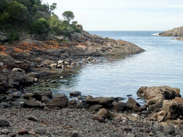 © Poyt448 Peter Woodard
The spot
Community-maintained
Community contribution: submitted by Daniel
Know before you go
Logged by the community, confirmed by mods
Low risk: Rocks at entry
Shallow rocky platform at the shoreline requires careful footing when entering and exiting the water.
Low risk: Boat traffic
Bass Point is a popular dive site and boat mooring area; snorkelers near the bommie should stay aware of vessels.
Low risk: Swell waves
Although Bushrangers Bay is sheltered, the outer point can experience sudden swell that creates surge around the reef.
Low risk: Boats at ramp
Small boat and kayak traffic near the boat ramp on busy weekends.
Low risk: Rock platforms at point
Sharp barnacle-covered rocks on the exposed headland can cause cuts; strong surge on southerly swells.
Low risk: Rocky reef edges
Sharp rocks and reef edges at the transition between inner and outer bay can cause cuts if not careful.
Wildlife Guide
No wildlife notes for this spot yet.
Gallery
4 photos from the community
Getting in
Shore entry
Entry
Drive south from Sydney on the M1, take the Shellharbour exit and follow Bass Point Tourist Road to the end. The car park is at the base of the headland. Alternatively, take the coastal path from Shell Cove Marina.
Parking & facilities
Free car park at the end of Bass Point Tourist Road, Shell Cove. Can fill by late morning on summer weekends.
toiletsparkingpicnic_tables
No entry fee.
Spot Map
Community
Gallery ┬╖ 4 photos
Trust
Is this spot real, accurate, still loved?
Spots near New South Wales

No nearby spots yet.
Needs verification
Quick verify
One tap helps the community keep this spot honest.
About this data
- Conditions last evaluated
- Spot data last updated
- Data sources
- Open-Meteo (marine & weather conditions), tide predictions via UTide, community contributors (descriptions, hazards, marine life).
- License
- Spot content licensed under CC BY-SA 4.0. How's the Spot is open source.
Weather & swell ┬╖ Open-Meteo marine & weather APIs Tides ┬╖ UTide harmonic analysis Sea & safety ┬╖ community reports