Brush Island (The Pinnacle) is a dramatic 47-hectare continental island rising steeply from the Tasman Sea, located about 2 km southeast of Bawley Point on the NSW South Coast. Encircled by rocky reefs and gutters in depths from 5–20 m, the island's rugged cliffs drop into clear temperate waters rich with sponge gardens and kelp forests. The island is a protected nature reserve and seabird breeding sanctuary, with little penguins nesting in its gullies. Snorkellers exploring the reefs around The Pinnacle can drift over boulder-strewn sea floors teeming with fish life in the sheltered lee of the island.
Brush Island (The Pinnacle)
IntermediateMAYBE
MAYBE
Fair. Experienced snorkellers only.
Showing last known conditions
Wave Height 0.5 mSwell Period 6.8 sWind Speed 3.5 knPrecipitation 26 mmTidal Phase slack
Last evaluated
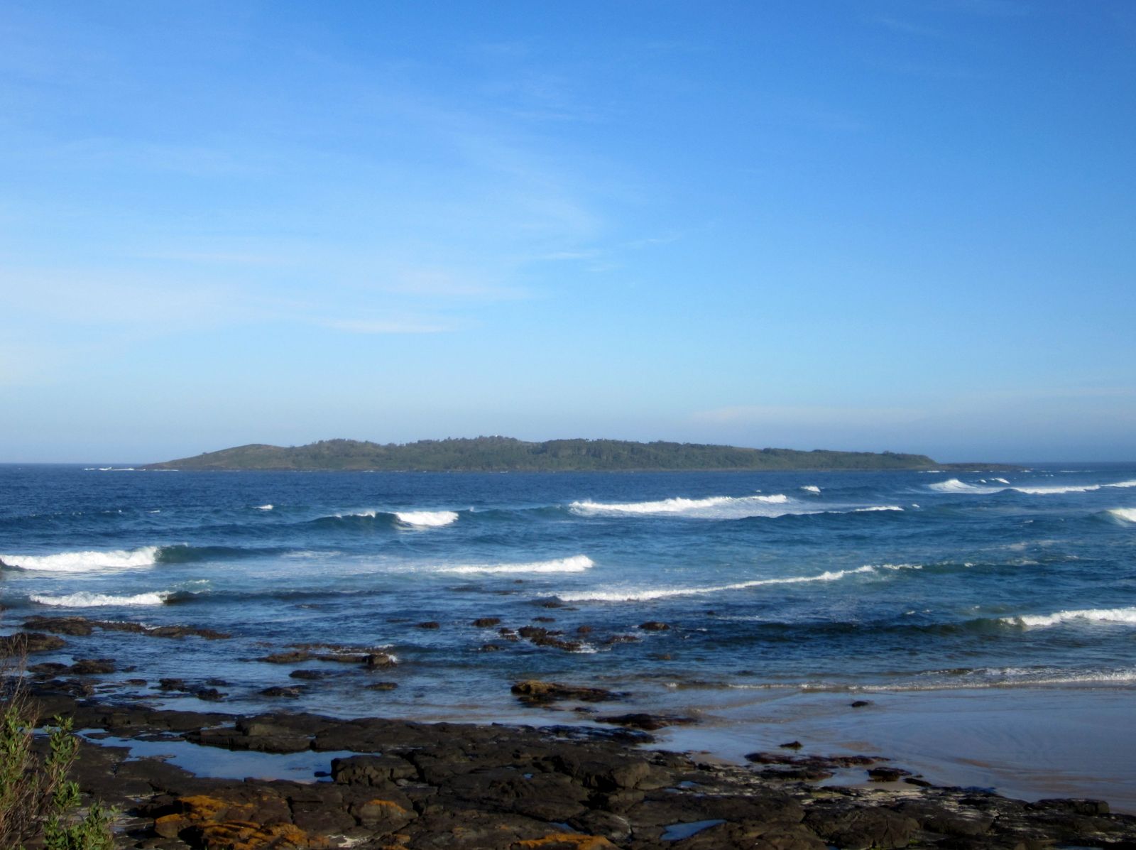
The spot
Community-maintained
Community contribution: submitted by Daniel
Know before you go
Logged by the community, confirmed by mods
Moderate risk: Strong ocean currents
Tidal currents can run strongly around the island, especially between the island and Murramarang Point where water channels through.
Moderate risk: Swell and surge
Exposed to southerly and easterly swells, creating dumping waves on rocky shorelines and surge around reef edges.
Low risk: Remote offshore access
The island is 2 km offshore with no landing facilities; requires a boat or kayak to reach with no shore support.
Low risk: Sharp reef and rock shelves
Steep rocky cliffs and submerged reef ledges can cause cuts and scrapes if not careful entering/exiting the water.
Wildlife Guide
No wildlife notes for this spot yet.
Gallery
1 photo from the community
Getting in
Boat
Entry
Brush Island lies approximately 2 km southeast of Bawley Point, NSW. The closest launch point is at Bawley Point beach or the nearby boat ramp at Kioloa. Paddle or motor out to the island — the crossing requires suitable conditions. The reef system around the island is best accessed by anchoring on the lee (western) side away from swell.
Parking & facilities
Parking available at Bawley Point beach access and at nearby Murramarang National Park car parks.
parking
No fees to access the island itself. Launching boats may incur local council fees at some ramps.
Spot Map
Community
Gallery ┬╖ 1 photos
Trust
Is this spot real, accurate, still loved?
Spots near Victoria

No nearby spots yet.
Needs verification
Quick verify
One tap helps the community keep this spot honest.
About this data
- Conditions last evaluated
- Spot data last updated
- Data sources
- Open-Meteo (marine & weather conditions), tide predictions via UTide, community contributors (descriptions, hazards, marine life).
- License
- Spot content licensed under CC BY-SA 4.0. How's the Spot is open source.
Weather & swell ┬╖ Open-Meteo marine & weather APIs Tides ┬╖ UTide harmonic analysis Sea & safety ┬╖ community reports