Bridport's offshore reef areas lie off the coast of this charming North East Tasmania holiday village on the edge of Andersons Bay. While the town's sheltered beaches (Croquet Lawn, Old Pier, Eastmans, and Goftons) offer calm inshore entry, the real snorkeling treasure is found further out over sandstone and artificial reef structures, including a deployed artificial reef at -41.0008° S, 148.02468° E. These temperate waters support rich marine ecosystems typical of Tasmania's cool coastline, with rocky reef terrain, kelp gardens, and diverse invertebrate life. Best accessed by boat or kayak from the Trent Water boat ramp, the offshore reefs provide clear views into the underwater world of Tasmania's northeast corner.
Bridport Snorkeling Sites (offshore reef areas)
IntermediateMAYBE
MAYBE
Fair. Experienced snorkellers only.
Showing last known conditions
Wave Height 0.0 mSwell Period 0.0 sWind Speed 4.7 knPrecipitation 13 mmTidal Phase flood
Last evaluated
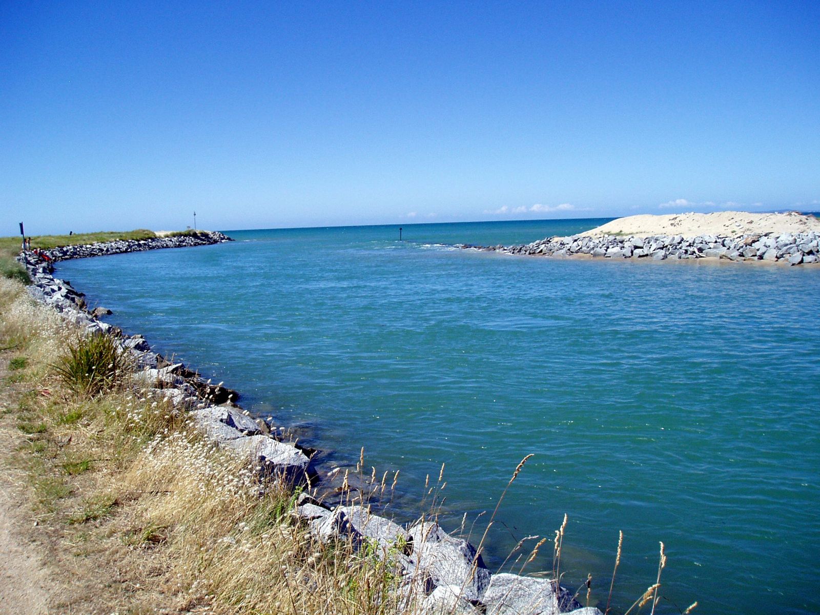
The spot
Community-maintained
Community contribution: submitted by Daniel
Know before you go
Logged by the community, confirmed by mods
Moderate risk: Cold water temperature
Tasmanian waters are cold year-round (12–17°C); prolonged exposure increases risk of hypothermia, especially without a wetsuit.
Moderate risk: Cold water temperatures
Tasmania's cool temperate waters can cause rapid fatigue and hypothermia. A wetsuit (5mm+) is essential even in summer.
Moderate risk: Variable weather and swell
Conditions can change quickly in Bass Strait. Offshore winds and building swells can make return to shore challenging.
Low risk: Estuary tidal currents
The Trent River estuary creates tidal flows that can produce moderate currents near the river mouth, especially on outgoing tides.
Low risk: Slippery granite rocks
Granite rocks and boulders at locations like Goftons Beach (Elephant Rock) and near the Old Pier can be slippery and uneven underfoot.
Low risk: Exposed beach conditions (Adams Beach)
Adams Beach is more exposed to Bass Strait swells and conditions—less suitable for beginner snorkelers during rougher weather.
Low risk: Rip currents
Occasional rip currents can develop near the northern and southern rock headlands, especially during larger swell events.
Low risk: Swell waves
Infrequent easterly swells can produce dumping shore break, particularly at mid-to-high tide.
Low risk: Boat traffic
Offshore reef areas may be shared with fishing and recreational vessels. Snorkelers should use a dive flag and stay vigilant.
Low risk: Tidal currents at Trent Water entrance
The estuarine entrance at Trent Water can have outgoing tidal currents that may be stronger than expected near the channel.
Low risk: Rocky outcrops and submerged granite
Granite outcrops and boulders are present along the foreshore and can be slippery, with submerged hazards at higher tide.
Low risk: Boat traffic near boat ramp
A boat ramp at the Trent Water area means occasional boat traffic near the swimming and snorkeling zones.
Low risk: Low Tide Restriction
The boat ramp area is restricted at low tide, becoming very shallow and limiting entry points for snorkeling.
Low risk: Tidal Currents
Tidal flows through the estuarine Trent Water entrance can create moderate currents, especially on outgoing tides.
Low risk: Pier remains
Submerged wooden piles and debris from the old pier can be present in the water. Watch for unseen obstructions near the structure.
Low risk: Changing tides
Tidal movement through the beach and pier area can cause unexpected currents, particularly around the old pier remains.
Wildlife Guide
No wildlife notes for this spot yet.
Gallery
5 photos from the community
Getting in
Boat
Entry
Bridport is approximately a 1-hour drive north-east of Launceston via the Tasman Highway (A3) and Bridport Road (B82). The offshore reef areas are best reached by boat launched from the Trent Water boat ramp in Bridport, or by kayak in calm conditions.
Parking & facilities
Parking is available adjacent to the Trent Water boat ramp area and along the Bridport foreshore near Anderson Street.
parkingboat_ramp
No fees for beach access or boat ramp use at Bridport. The artificial reef is public.
Spot Map
Community
Gallery ┬╖ 5 photos
Trust
Is this spot real, accurate, still loved?
Spots near Tasmania

No nearby spots yet.
Needs verification
Quick verify
One tap helps the community keep this spot honest.
About this data
- Conditions last evaluated
- Spot data last updated
- Data sources
- Open-Meteo (marine & weather conditions), tide predictions via UTide, community contributors (descriptions, hazards, marine life).
- License
- Spot content licensed under CC BY-SA 4.0. How's the Spot is open source.
Weather & swell ┬╖ Open-Meteo marine & weather APIs Tides ┬╖ UTide harmonic analysis Sea & safety ┬╖ community reports