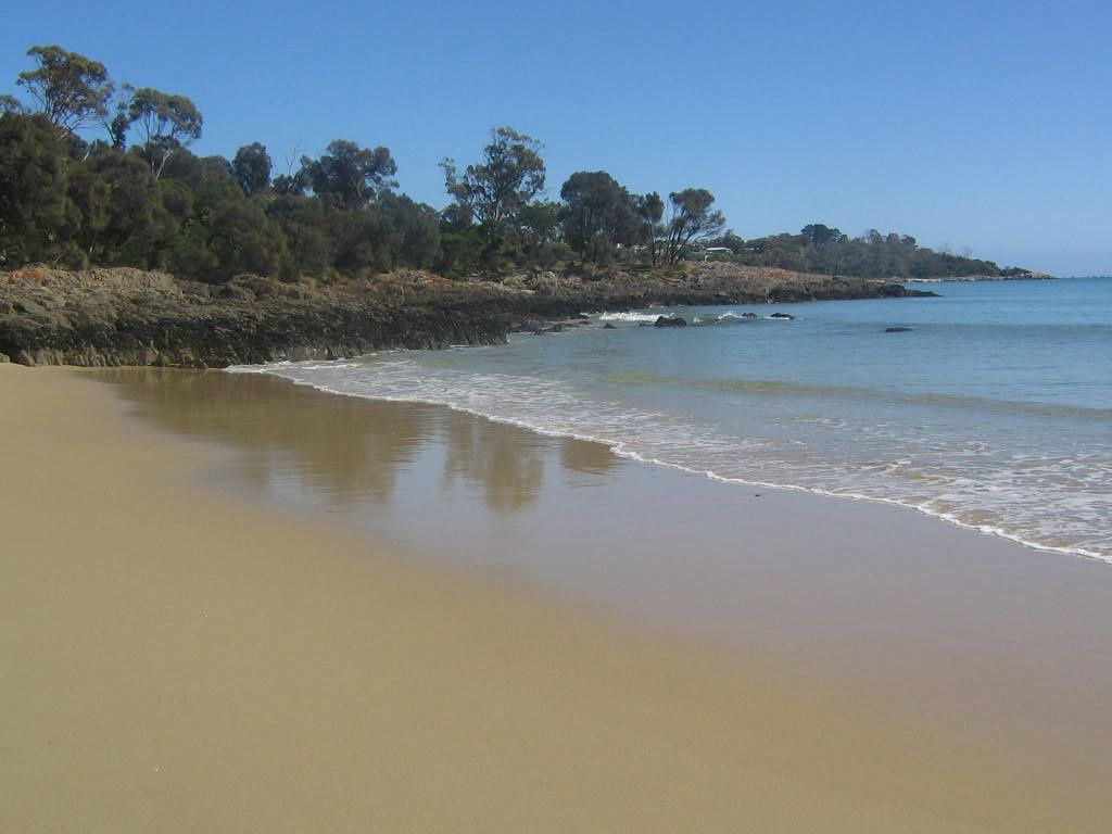
Nestled on the shimmering waters of Anderson Bay on Tasmania's north-east coast, Bridport Beach offers a sheltered, family-friendly snorkeling haven. This sweeping stretch of white sand is backed by coastal reserves and wildflower-filled bushland, with rocky granite outcrops and a historic jetty creating mini marine habitats just offshore. The calm, protected waters of the bay — shielded from Bass Strait swells — make it an ideal spot to float above sandy seabeds, seagrass meadows, and granite boulder gardens teeming with temperate-water marine life. The complex tapestry of secluded pocket beaches, from Mermaids Beach to Adams Beach, provides multiple entry points for exploration.
Bridport Beach (Anderson Bay)
BeginnerGO
GO
It's a go.
Showing last known conditions
Wave Height 0.2 mSwell Period 4.3 sWind Speed 6.9 knPrecipitation 9.1 mmTidal Phase flood
Last evaluated
The spot
Community-maintained
Community contribution: submitted by Daniel
Know before you go
Logged by the community, confirmed by mods
Moderate risk: Variable weather & swell
The north-east coast can experience sudden weather changes and wind-driven chop that reduces visibility and creates challenging conditions for swimmers.
Low risk: Variable Weather
Tasmania's north-east coast can experience sudden wind shifts and cold fronts, reducing visibility and creating choppy conditions.
Low risk: Weed / Seagrass
Shallow seagrass beds near the jetty can entangle fins and obscure sandy patches; care needed when entering and exiting.
Low risk: Cold Water Temperatures
Temperate Tasmanian waters average 12-18°C; prolonged exposure without a wetsuit poses a risk of hypothermia.
Low risk: Outgoing tide current near river mouths
The Little Forester River meets the bay at the southern end of Adams Beach; currents can develop near the mouth on outgoing tides.
Low risk: Granite rock outcrops and uneven seabed
Granite boulders and rocky patches near headlands like Granite Point and Elephant Rock can be sharp underfoot.
Low risk: Boat traffic near boat ramp
The Trent Water area has a boat ramp and fishing area; boat traffic can be present during summer months.
Low risk: Remote location
Anderson Bay is isolated with limited mobile reception and no on-site emergency services; self-rescue or a long drive to the nearest help may be required.
Low risk: Variable weather and swell
Exposed to easterly and northerly winds; sudden southerly changes can pick up quickly.
Low risk: Rocky headlands
The rocky points at either end of the beach can have sharp edges and slippery surfaces — use care when exploring.
Low risk: Tidal currents near river mouth
The Little Forester River enters at the eastern end of Adams Beach; outgoing tides can create moderate currents in this area.
Low risk: Boat traffic
Anderson Bay is used by recreational and charter fishing boats, particularly around the boat ramp and jetty areas.
Low risk: Rocky outcrops
Granite boulders and reef platforms along the foreshore can be slippery at low tide and may have sharp barnacle encrustations.
Low risk: Southerly wind swell
Strong southerly winds can kick up choppy conditions and reduce water clarity, making snorkelling less enjoyable.
Low risk: Rip currents
Occasional rip currents can develop near the northern headland after periods of larger swell.
Wildlife Guide
No wildlife notes for this spot yet.
Gallery
3 photos from the community
Getting in
Shore entry
Entry
Bridport is 85 km (1 hour) north-east of Launceston via the Tasman Highway (A3) and Bridport Road (B82). The main beach access is along the Bridport Foreshore Reserve, off Main Street. Multiple beach entry points (Goftons Beach, Old Pier Beach, and Mermaids Beach) are a short walk from the town centre.
Parking & facilities
Free street parking available along Main Street and at the Bridport Foreshore Reserve car park near the boat ramp. Additional parking at the Old Pier area.
toiletsparkingpicnic_tablesboat_ramp
No fees for beach access or snorkeling.
Spot Map
Community
Gallery ┬╖ 3 photos
Trust
Is this spot real, accurate, still loved?
Spots near Tasmania

No nearby spots yet.
Needs verification
Quick verify
One tap helps the community keep this spot honest.
About this data
- Conditions last evaluated
- Spot data last updated
- Data sources
- Open-Meteo (marine & weather conditions), tide predictions via UTide, community contributors (descriptions, hazards, marine life).
- License
- Spot content licensed under CC BY-SA 4.0. How's the Spot is open source.
Weather & swell ┬╖ Open-Meteo marine & weather APIs Tides ┬╖ UTide harmonic analysis Sea & safety ┬╖ community reports