A limestone reef at Hillarys Boat Harbour featuring caves, swim-through ledges, western rock lobster colonies, and 10 underwater interpretive plaques. The reef is accessible by swimming 75m from the southern sea wall, providing an educational snorkeling experience.
Boyinaboat Reef
Western Australia Intermediate
Hazardous — Do Not Enter The Water.
HighEffective waves 3.5m, wind 60kt, swell 10.8s. Coastal shelter index 1.0×. Confidence: High.
A limestone reef at Hillarys Boat Harbour featuring caves, swim-through ledges, western rock lobster colonies, and 10 underwater interpretive plaques. The reef is accessible by swimming 75m from the southern sea wall,…
Today's Conditions
Boyinaboat Reef
Confidence:High (100%)
CSI:1.0×
Waves
3.5m
Wind
60kt
Swell
10.8s
Water Visibility
POORmedium confidence 4/6 signals
Evaluated •••
Tide Chart
No tide data available for this spot.
Hourly Breakdown
Hourly conditions
Excellent Good Fair Poor Hazardous
Best time today: 12:00 AM· Hazardous
3p
6p
9p
12a
3a
6a
9a
12p
| Hour | Score | Waves | Wind | Swell |
|---|---|---|---|---|
| 12:00 AM | Hazardous | 3.8m | 62kt | 11s |
| 1:00 AM | Hazardous | 3.8m | 62kt | 11s |
| 2:00 AM | Hazardous | 3.8m | 62kt | 11s |
| 3:00 AM | Hazardous | 3.8m | 62kt | 11s |
| 4:00 AM | Hazardous | 3.8m | 62kt | 11s |
| 5:00 AM | Hazardous | 3.8m | 62kt | 11s |
| 6:00 AM | Hazardous | 3.8m | 62kt | 11s |
| 7:00 AM | Hazardous | 3.8m | 62kt | 11s |
| 8:00 AM | Hazardous | 3.8m | 62kt | 11s |
| 9:00 AM | Hazardous | 3.8m | 56kt | 11s |
| 10:00 AM | Hazardous | 3.9m | 52kt | 11s |
| 11:00 AM | Hazardous | 4.0m | 50kt | 11s |
| 12:00 PM | Hazardous | 3.9m | 59kt | 11s |
| 1:00 PM | Hazardous | 3.7m | 60kt | 11s |
| 2:00 PM | Hazardous | 3.6m | 61kt | 11s |
| 3:00 PM | Hazardous | 3.4m | 56kt | 11s |
| 4:00 PM | Hazardous | 3.3m | 64kt | 11s |
| 5:00 PM | Hazardous | 3.2m | 66kt | 11s |
| 6:00 PM | Hazardous | 3.2m | 62kt | 11s |
| 7:00 PM | Hazardous | 3.2m | 58kt | 10s |
| 8:00 PM | Hazardous | 3.2m | 54kt | 10s |
| 9:00 PM | Hazardous | 3.2m | 52kt | 10s |
| 10:00 PM | Hazardous | 3.3m | 50kt | 10s |
| 11:00 PM | Hazardous | 3.3m | 58kt | 10s |
7-Day Forecast
Swipe to see all 7 days×
About this spot
Getting There
Directions
Park behind AQWA on Southside Drive at Hillarys Boat Harbour, swim 75m from the southern sea wall.
Parking
Parking available at Hillarys Boat Harbour
Facilities
ToiletsParkingBoat Ramp
Access Method
Shore EntryHazards
- Strenuous Open-Water Swim warning
75m open-water swim required to reach the reef.
- Heavy Boat Traffic warning
Heavy boat traffic in the harbour area.
- Deep Caves caution
Deep caves and crevices pose entrapment risk.
Difficulty & Marine Life
Marine Life
- Western Rock Lobster
Colonies of western rock lobster (Maran) in the reef.
Spot Map
Snorkel route guide map for this spot.
Wildlife Guide
May 1 – Jul 31 (any year)
Fish (7)
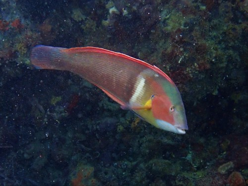
Photo: (c) J. Martin Crossley, some rights reserved (CC BY-NC-SA), uploaded by J. Martin Crossley
LikelyFish
Western King Wrasse
Coris auricularis
3 recent observations

Photo: (c) J. Martin Crossley, some rights reserved (CC BY-NC-SA), uploaded by J. Martin Crossley
RareFish
Redlip morwong
Goniistius rubrolabiatus
2 recent observations
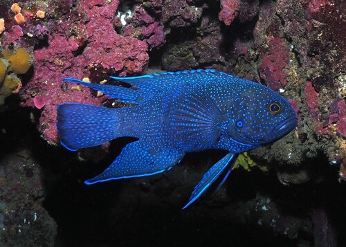
Photo: (c) Phil W, some rights reserved (CC BY-NC), uploaded by Phil W
RareFish
Southern Blue Devil
Paraplesiops meleagris
2 recent observations
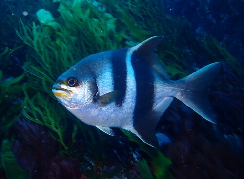
Photo: (c) J. Martin Crossley, some rights reserved (CC BY-NC-SA), uploaded by J. Martin Crossley
RareFish
Banded Sweep
Scorpis georgiana
1 recent observation
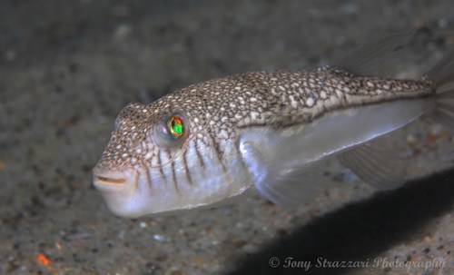
Photo: (c) Tony Strazzari, some rights reserved (CC BY-NC), uploaded by Tony Strazzari
RareFish
Weeping Toadfish
Torquigener pleurogramma
1 recent observation
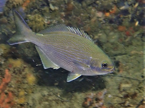
Photo: (c) J. Martin Crossley, some rights reserved (CC BY-NC-SA), uploaded by J. Martin Crossley
RareFish
Western Buffalo Bream
Kyphosus cornelii
1 recent observation
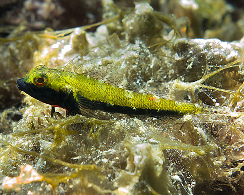
Photo: (c) Glen Whisson, some rights reserved (CC BY-NC), uploaded by Glen Whisson
RareFish
Blackthroat Threefin
Helcogramma decurrens
1 recent observation
30 species recorded · Data from iNaturalist
Species data and photos provided by iNaturalist contributors. Individual photo attributions are listed per species. Photos may be licensed under CC-BY-NC.
Spots near Western Australia

No nearby spots yet.
Check back soon — we add new snorkel spots regularly.
Wetsuit Recommendation
19.1°C5mm full wetsuit
The water is cool — a thicker suit will keep you comfortable
About this data
- Conditions last evaluated
- Spot data last updated
- Data sources
- Open-Meteo (weather & tides), Bureau of Meteorology (sea state), community contributors (descriptions, hazards, marine life).
- License
- Spot content licensed under CC BY-SA 4.0. HowsTheSpot is open source.