Bowen Island's eastern side faces the open Tasman Sea at the entrance to Jervis Bay, 250 m off Bherwerre Peninsula. Exposed to ocean swell, this sandstone-lined shoreline drops into clear, nutrient-rich waters that attract seals, rays and pelagic fish. Part of Booderee National Park and the Jervis Bay Marine Park, the area is also a critical seabird nesting site for little penguins and shearwaters. The dramatic cliff-and-boulder terrain above water gives way to rocky reefs and kelp gardens below, offering adventurous snorkellers a wilder, less-visited alternative to the bay's calm western beaches.
Bowen Island (eastern side)
AdvancedMAYBE
MAYBE
Fair. Experienced snorkellers only.
Showing last known conditions
Wave Height 0.1 mSwell Period 9.3 sWind Speed 11 knPrecipitation 24 mmTidal Phase slack
Last evaluated
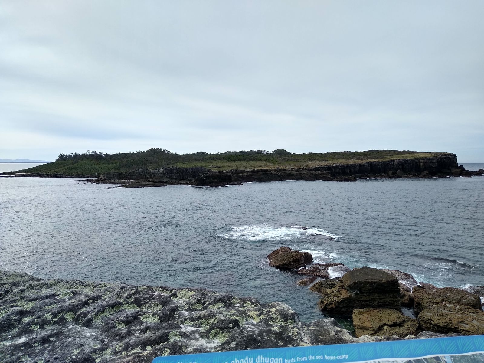 © Mx. Granger
DANGER: Explicit Risks Present
Bowen Island (eastern side) has hazards marked as danger. Entering the water here means you may face serious risks to your personal safety.
- Ocean swell and surge danger
The eastern side is exposed to Tasman Sea swells, creating powerful surge zones against the rocks that can pin snorkellers against the shoreline.
The spot
Community-maintained
Community contribution: submitted by Daniel
Know before you go
Logged by the community, confirmed by mods
High risk: Ocean swell and surge
The eastern side is exposed to Tasman Sea swells, creating powerful surge zones against the rocks that can pin snorkellers against the shoreline.
Moderate risk: Strong currents
Tidal flows around the island's eastern tip can produce unpredictable currents, especially on outgoing tides.
Moderate risk: Rocky entry and exit
No sandy beach access; entry is over sharp sandstone boulders and reef ledges that become slippery at low tide.
Moderate risk: Southerly swell exposure
The only protected area is the northern end; strong southerly swells can create dangerous conditions on other sides of the island.
Moderate risk: Depth changes rapidly
The reef drops from shallow 5 m areas to over 27 m sand edge within short distance, which can surprise inexperienced snorkelers.
Low risk: Isolated location
Access requires a boat or kayak crossing of 250 m of open water from Bherwerre Peninsula with no immediate emergency services on the island.
Low risk: Strong currents at entrance
Tidal currents can be strong around the entrance of Jervis Bay near the island, especially on changing tides.
Low risk: Restricted island access
Bowen Island itself is a seabird sanctuary (little penguins, shearwaters) with no public landing permitted – access is strictly by water only.
Wildlife Guide
No wildlife notes for this spot yet.
Gallery
3 photos from the community
Getting in
Kayak
Entry
Bowen Island sits 250 m off the tip of Bherwerre Peninsula at the southern entrance to Jervis Bay. The eastern side is best accessed by kayak or boat launched from Huskisson or Greenpatch (Booderee National Park). Paddle around the southern tip of the island to reach the exposed eastern shoreline. Private watercraft or guided kayak tours are the only viable options; there is no direct shore access from the mainland.
Parking & facilities
Park at Booderee National Park's Greenpatch or Cave Beach car parks (entry fee applies). From Greenpatch, it's a short carry to the beach launch point.
parkingtoiletspicnic_tables
Booderee National Park entry fee (approx. AUD 13 per vehicle per day).
Spot Map
Community
Gallery ┬╖ 3 photos
Trust
Is this spot real, accurate, still loved?
Spots near New South Wales

No nearby spots yet.
Needs verification
Quick verify
One tap helps the community keep this spot honest.
About this data
- Conditions last evaluated
- Spot data last updated
- Data sources
- Open-Meteo (marine & weather conditions), tide predictions via UTide, community contributors (descriptions, hazards, marine life).
- License
- Spot content licensed under CC BY-SA 4.0. How's the Spot is open source.
Weather & swell ┬╖ Open-Meteo marine & weather APIs Tides ┬╖ UTide harmonic analysis Sea & safety ┬╖ community reports