Bournda Island is a small rocky headland-island that splits North Tura Beach and Bournda Beach within Bournda National Park on the NSW Far South Coast. Connected to the mainland at low tide via a sandy causeway, this exposed outcrop features a sea cave at its base and offers dramatic ocean views over the Sapphire Coast. The surrounding waters are part of a pristine marine environment teeming with temperate reef life, while the island's sheltered eastern side can provide calmer conditions for a snorkel when the swell is low.
Bournda Island
IntermediateGO
GO
It's a go.
Showing last known conditions
Wave Height 0.5 mSwell Period 6.8 sWind Speed 4.3 knPrecipitation 16 mmTidal Phase flood
Last evaluated
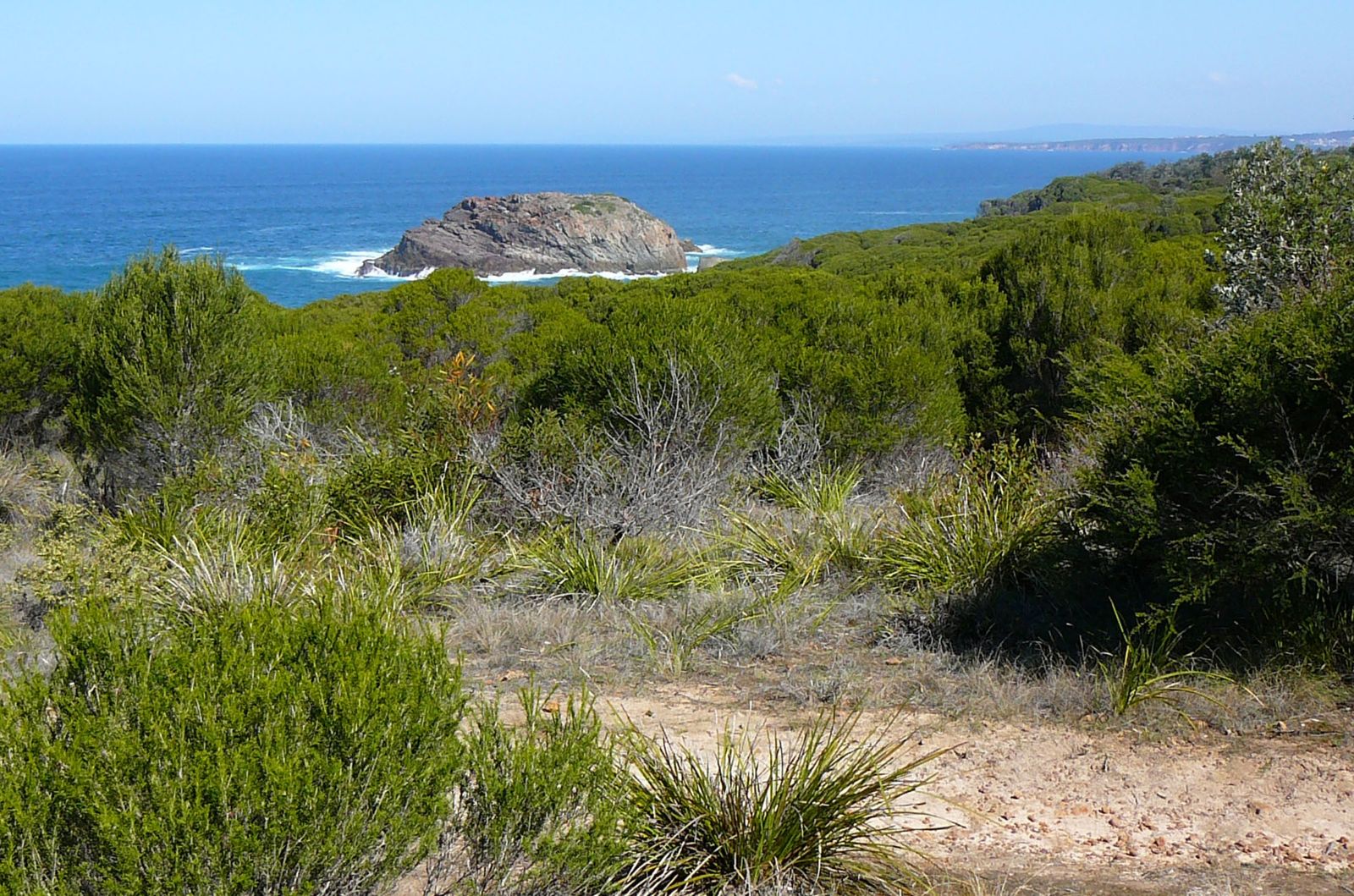 © Mark Andrews
The spot
Community-maintained
Community contribution: submitted by Daniel
Know before you go
Logged by the community, confirmed by mods
Moderate risk: Tidal Isolation
Bournda Island is only accessible at low tide via a sandy causeway; incoming tide can cut off access, stranding snorkelers on the island.
Moderate risk: Ocean Swell and Surge
Exposed to southerly and easterly swells, creating dangerous surge conditions around the rocky shoreline and sea cave, especially during higher swell periods.
Low risk: Rocks and Reef
Sharp oyster-covered rocks and shallow reef surround the island; care needed when entering and exiting the water, particularly in surge conditions.
Wildlife Guide
No wildlife notes for this spot yet.
Gallery
1 photo from the community
Getting in
Shore entry
Entry
From Tathra, drive south on the Sapphire Coast Drive / Bega Valley road. Turn into Bournda National Park via Bournda Road. Park at the Bournda Lagoon car park and follow the 2.1 km walking trail across Bournda Beach to the island. The island is reachable by foot across the sand at low tide only.
Parking & facilities
Bournda Lagoon car park within Bournda National Park. Also Hobart Beach campground parking and Wallagoot Gap parking areas available.
parkingtoiletspicnic_tables
$8 per vehicle per day park entry fee (self-registration, bring correct change).
Spot Map
Community
Gallery ┬╖ 1 photos
Trust
Is this spot real, accurate, still loved?
Spots near Victoria

No nearby spots yet.
Needs verification
Quick verify
One tap helps the community keep this spot honest.
About this data
- Conditions last evaluated
- Spot data last updated
- Data sources
- Open-Meteo (marine & weather conditions), tide predictions via UTide, community contributors (descriptions, hazards, marine life).
- License
- Spot content licensed under CC BY-SA 4.0. How's the Spot is open source.
Weather & swell ┬╖ Open-Meteo marine & weather APIs Tides ┬╖ UTide harmonic analysis Sea & safety ┬╖ community reports