Boullanger Island lies just one kilometre offshore from Island Point at the southern end of Jurien Bay Marine Park, its shallow western flank a sun-dappled seagrass meadow perfect for family snorkelling. The Jurien Bay Underwater Interpretive Snorkel and Dive Trail weaves through water 2.5 to 6 metres deep past an artificial reef of over 70 reef balls, designed to mimic natural limestone systems and teeming with marine life. The island's sheltered lee offers calm, protected waters while the surrounding marine park — the only major Australian sea lion breeding colony on the west coast — provides an extraordinary backdrop of limestone reefs, caves, and grottos draped in colourful sponges and sea squirts.
Boullanger Island (Jurien Bay Underwater Interpretive Snorkel and Dive Trail)
BeginnerSKIP
SKIP
Poor conditions. Stay out today.
Showing last known conditions
Wave Height 1.9 mSwell Period 11 sWind Speed 2.4 knPrecipitation 2.5 mmTidal Phase ebb
Last evaluated
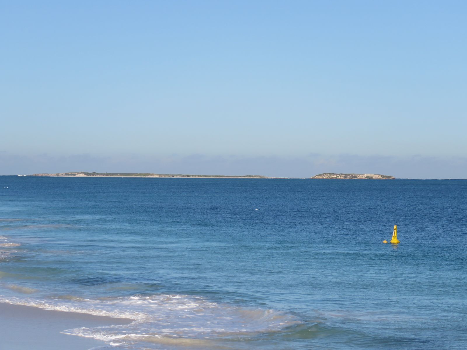 © Calistemon
The spot
Community-maintained
Community contribution: submitted by Daniel
Know before you go
Logged by the community, confirmed by mods
Moderate risk: Open ocean swells
Exposed position offshore can experience moderate to large swells, especially in winter months (June–August).
Moderate risk: Strong currents
Oceanic currents can sweep around the island and over bommies; strong swimming ability required.
Moderate risk: Tidal currents around island points
Strong outflow currents can develop around the island's southern and western points during tidal changes, particularly on larger tide movements.
Moderate risk: Limited access / remote location
No direct shore access from the mainland. Snorkelers must arrive by boat or kayak, so self-rescue options are limited.
Moderate risk: Strong currents around points
Tidal currents can pick up around the island's northern and southern points, especially on outgoing tides.
Low risk: Boat traffic
The island is accessed by boat and sits in a busy marine park frequented by recreational vessels. Snorkellers should stay vigilant and surface with care.
Low risk: Strong sea breezes
Afternoon south-westerly sea breezes can chop up the water surface and reduce visibility, particularly during summer afternoons.
Low risk: Sharp limestone reef
Exposed limestone reef edges and bommies can cause cuts and scrapes. Wear protective footwear and avoid touching the reef.
Low risk: Sharp coral
The bommies are live coral formations with sharp edges; contact can cause cuts.
Low risk: Afternoon sea breeze chop
Summer sea breezes can create choppy conditions and surge around the island's exposed western side, making navigation and snorkeling more challenging in the afternoon.
Low risk: Marine wildlife interaction regulations
Strict guidelines apply: maintain distance, do not touch sea lions, and never land on islands occupied by sea lions. Fines apply for non-compliance.
Low risk: Wind and swell conditions
Afternoon sea breezes can create choppy water and reduced visibility. Early morning tours are recommended for calmest conditions.
Low risk: Cold water temperatures
Water temperatures range 18–23°C year-round. Wetsuits are provided by tour operators but cold shock is a risk for unprepared swimmers, especially in winter (June–August).
Low risk: Strong currents around island points
Tidal currents can pick up around the rocky points of the island, particularly during tidal changes.
Low risk: Sharp reef and rocky shore
The island's fringing reef and rocky coastline have sharp limestone and coral edges; reef shoes or fins are strongly recommended.
Low risk: Currents in channels
Tidal currents can run through passages between islands in the marine park; check conditions before crossing.
Low risk: Marine stingers
Box jellyfish and other marine stingers may be present during warmer months (November to April).
Low risk: Marine park zone restrictions
Certain areas have restrictions on spearfishing, crabbing, and netting. Check signage and know your zones before entering.
Low risk: Weather-dependent conditions
Tours and access run subject to weather. Wind and swell can affect water clarity and safety, particularly on the exposed sides of the island.
Low risk: Wind chop / swell
The western side is sheltered but conditions can change quickly with sea breezes; afternoon chop reduces visibility.
Low risk: Interpretive Trail Buried in Sand
The Jurien Bay Underwater Interpretive Snorkel and Dive Trail (near the old jetty) is reported to be covered with sand. Visitors should not rely on finding marked trail plaques.
Low risk: Remote Island Access
Small boat/watercraft required to reach the island; no bridge access. Snorkellers should be competent swimmers and be prepared for open-water conditions outside the protected lagoon.
Low risk: Trail may be sand-covered
The interpretive trail markers and reef balls have been periodically covered by shifting sand, reducing navigability of the formal trail.
Wildlife Guide
No wildlife notes for this spot yet.
Gallery
4 photos from the community
Getting in
Boat
Entry
Boullanger Island is located 1 km offshore from Island Point at the southern end of Jurien Bay, approximately 2.5 hours north of Perth via Indian Ocean Drive. No direct road access to the island; access is by boat, kayak, or guided snorkel tour from Jurien Bay.
Parking & facilities
Parking available at the Jurien Bay boat ramp and marina precinct, and at Island Point lookout area. Can be crowded during summer and Easter holidays.
toiletsparkingboat_ramppicnic_tables
No fee for snorkelling the site itself. Guided tours from Jurien Bay start from approximately $115 per person. Snorkel trail swim cards available from local shops for a $5 donation.
Spot Map
Community
Gallery ┬╖ 4 photos
Trust
Is this spot real, accurate, still loved?
Spots near Western Australia

No nearby spots yet.
Needs verification
Quick verify
One tap helps the community keep this spot honest.
About this data
- Conditions last evaluated
- Spot data last updated
- Data sources
- Open-Meteo (marine & weather conditions), tide predictions via UTide, community contributors (descriptions, hazards, marine life).
- License
- Spot content licensed under CC BY-SA 4.0. How's the Spot is open source.
Weather & swell ┬╖ Open-Meteo marine & weather APIs Tides ┬╖ UTide harmonic analysis Sea & safety ┬╖ community reports