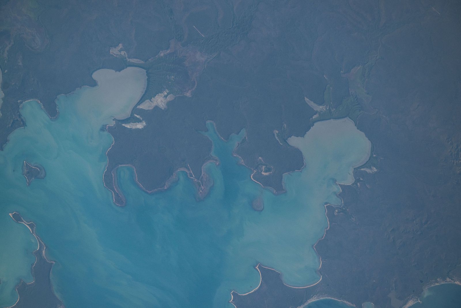
Blue Mud Bay is a vast, shallow, partly enclosed bay on the remote eastern coast of Arnhem Land, facing Groote Eylandt across the Gulf of Carpentaria. Spanning 90 km in length and up to 35 km wide, its inner coastline is a mosaic of small bays, inlets, headlands, and islands bordered by intertidal mudflats, mangroves, and freshwater floodplains. Snorkelers exploring the sandy shallows and rocky headlands can experience one of Australia's most pristine and culturally significant coastal environments — the bay was the site of the landmark Blue Mud Bay sea rights case. The surrounding Laynhapuy Indigenous Protected Area protects this wild, untouched landscape. Access is restricted; permits from the Northern Land Council are required.
Blue Mud Bay
AdvancedGO
GO
It's a go.
Showing last known conditions
Wave Height 0.0 mSwell Period 2.7 sWind Speed 5.5 knPrecipitation 1.2 mmTidal Phase slack
Last evaluated
DANGER: Explicit Risks Present
Blue Mud Bay has hazards marked as danger. Entering the water here means you may face serious risks to your personal safety.
- Saltwater Crocodile Hazard danger
Saltwater crocodiles (Crocodylus porosus) inhabit the tidal waters, mangroves, and river mouths of Blue Mud Bay. They are present year-round and pose a serious threat to swimmers and snorkelers.
The spot
Community-maintained
Community contribution: submitted by Daniel
Know before you go
Logged by the community, confirmed by mods
High risk: Saltwater Crocodile Hazard
Saltwater crocodiles (Crocodylus porosus) inhabit the tidal waters, mangroves, and river mouths of Blue Mud Bay. They are present year-round and pose a serious threat to swimmers and snorkelers.
Moderate risk: Tidal Currents
Large tidal movements and strong currents occur in the shallow, partly enclosed bay, especially near the mouth between Cape Shield and Cape Barrow.
Moderate risk: Box Jellyfish
Box jellyfish (Chironex fleckeri) may be present in the warm coastal waters of the Gulf of Carpentaria during the wet season.
Moderate risk: Extreme Remoteness
Extreme remoteness — the nearest major town (Nhulunbuy) is 210 km away via unsealed roads. No nearby medical facilities. Limited mobile reception.
Wildlife Guide
No wildlife notes for this spot yet.
Gallery
1 photo from the community
Getting in
Shore entry
Entry
Blue Mud Bay is accessible via a 210 km/3-hour drive from Nhulunbuy (Gove) on unsealed roads. The Bäniyala homeland community sits on the bay's shores. A permit from the Northern Land Council is mandatory for transit to this Aboriginal freehold land. Camping at Dholuwuy Campground requires a separate permit from the Bäniyala Garrangali Aboriginal Corporation.
Parking & facilities
Limited parking available at Dholuwuy Campground near the beach.
toiletsdrinking_waterpicnic_tables
Permit required from Northern Land Council; camping fees apply at Dholuwuy Campground (contact Bäniyala Garrangali Aboriginal Corporation for current rates).
Spot Map
Community
Gallery ┬╖ 1 photos
Trust
Is this spot real, accurate, still loved?
Spots near Northern Territory

No nearby spots yet.
Needs verification
Quick verify
One tap helps the community keep this spot honest.
About this data
- Conditions last evaluated
- Spot data last updated
- Data sources
- Open-Meteo (marine & weather conditions), tide predictions via UTide, community contributors (descriptions, hazards, marine life).
- License
- Spot content licensed under CC BY-SA 4.0. How's the Spot is open source.
Weather & swell ┬╖ Open-Meteo marine & weather APIs Tides ┬╖ UTide harmonic analysis Sea & safety ┬╖ community reports