The Blue Holes are mysterious, deeper depressions within the coral reef systems of the Dampier Archipelago, a 42-island chain off the Pilbara coast near Karratha. These natural sinkholes in the limestone reef structure create calm, clear pools that attract a dense concentration of marine life. Surrounded by vibrant coral gardens, the site offers excellent snorkelling visibility during the cooler months. The archipelago sits within Murujuga National Park, home to over 1 million ancient rock petroglyphs. Access is exclusively by boat — either via guided tours from Hampton Harbour or self-guided expeditions — and the snorkelling rewards visitors with encounters with tropical fish, rays, turtles, and from June to October, migrating humpback whales.
Blue Holes (Dampier Archipelago)
It's a go.
Showing last known conditions
Last evaluated
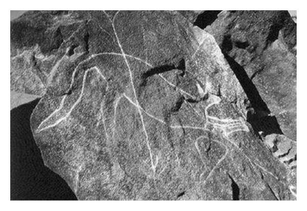 © Derek Hodgson
The spot
Community-maintained
Community contribution: submitted by Daniel
Know before you go
Logged by the community, confirmed by mods
Moderate risk: Marine stingers (box jellyfish)
Potentially dangerous jellyfish may be present in warmer months (November to May).
Moderate risk: Remote location
Access is by boat only with no immediate medical facilities nearby. Snorkel with a tour or experienced skipper.
Moderate risk: Strong tidal currents
Tidal flows between islands and around outer reefs can be strong and unpredictable, especially on larger tides.
Moderate risk: Remote island locations
Snorkel sites are remote with no facilities or immediate emergency services on the islands.
Low risk: Outgoing tide currents
Strong tidal flows can develop around island channels and reef passes, especially on outgoing tides.
Low risk: Coral bleaching & sharp coral
Coral bleaching events have affected local reefs; sharp coral can cause cuts. Wear protective footwear.
Low risk: Marine stingers
Box jellyfish and other marine stingers may be present during the warmer months (November to April).
Low risk: Coral bleaching events
Recent coral bleaching has affected some reef sites; be mindful of fragile coral ecosystems.
Low risk: Boat traffic
Shipping channels and recreational boat traffic in the archipelago require vigilance when snorkeling near marked channels.
Low risk: Coral and rock cuts
Sharp coral and limestone formations can cause cuts and abrasions; wearing reef shoes is strongly advised.
Low risk: Stinging jellyfish and marine stingers
Box jellyfish and other stingers may be present during the warmer months from October to May.
Wildlife Guide
No wildlife notes for this spot yet.
Gallery
2 photos from the community
Getting in
The Dampier Archipelago is located off the coast of Dampier, approximately 20 km northwest of Karratha in Western Australia's Pilbara region. Public boat ramps are located at Dampier, Karratha Back Beach, Johns Creek, Point Samson and Cossack. Guided snorkel tours depart from the Hampton Harbour Boat and Sailing Club in Dampier. The islands have no facilities — all water, food and safety gear must be brought.
Ample parking is available at the Hampton Harbour Boat and Sailing Club (for tour guests) and at public boat ramp car parks in Dampier and Karratha.
No entry fee for the archipelago itself. Guided snorkel tours are approximately $330 per person. Self-guided visitors need their own boat and all supplies.
Spot Map
Community
Trust
Is this spot real, accurate, still loved?
Spots near Western Australia

No nearby spots yet.
Quick verify
One tap helps the community keep this spot honest.
About this data
- Conditions last evaluated
- Spot data last updated
- Data sources
- Open-Meteo (marine & weather conditions), tide predictions via UTide, community contributors (descriptions, hazards, marine life).
- License
- Spot content licensed under CC BY-SA 4.0. How's the Spot is open source.