Blackwall Reach is a renowned shore-diving and snorkeling site along the Swan River in Bicton, Perth. Sheltered limestone cliffs up to 11 metres high fringe this deep, riverine channel, creating a unique urban snorkeling environment with excellent visibility. The site is dotted with sunken wrecks — including a 14-metre barge, a vehicle dump, and several boats — making it a fascinating underwater playground. Snorkellers can explore drop-offs, ledges, and scattered debris while drifting with the gentle river current. It's a favourite spot for both cliff jumping and underwater exploration, right in the Swan River's estuary near Fremantle.
Blackwall Reach
IntermediateMAYBE
MAYBE
Fair. Experienced snorkellers only.
Showing last known conditions
Wave Height 0.8 mSwell Period 11 sWind Speed 3.0 knPrecipitation 11 mmTidal Phase ebb
Last evaluated
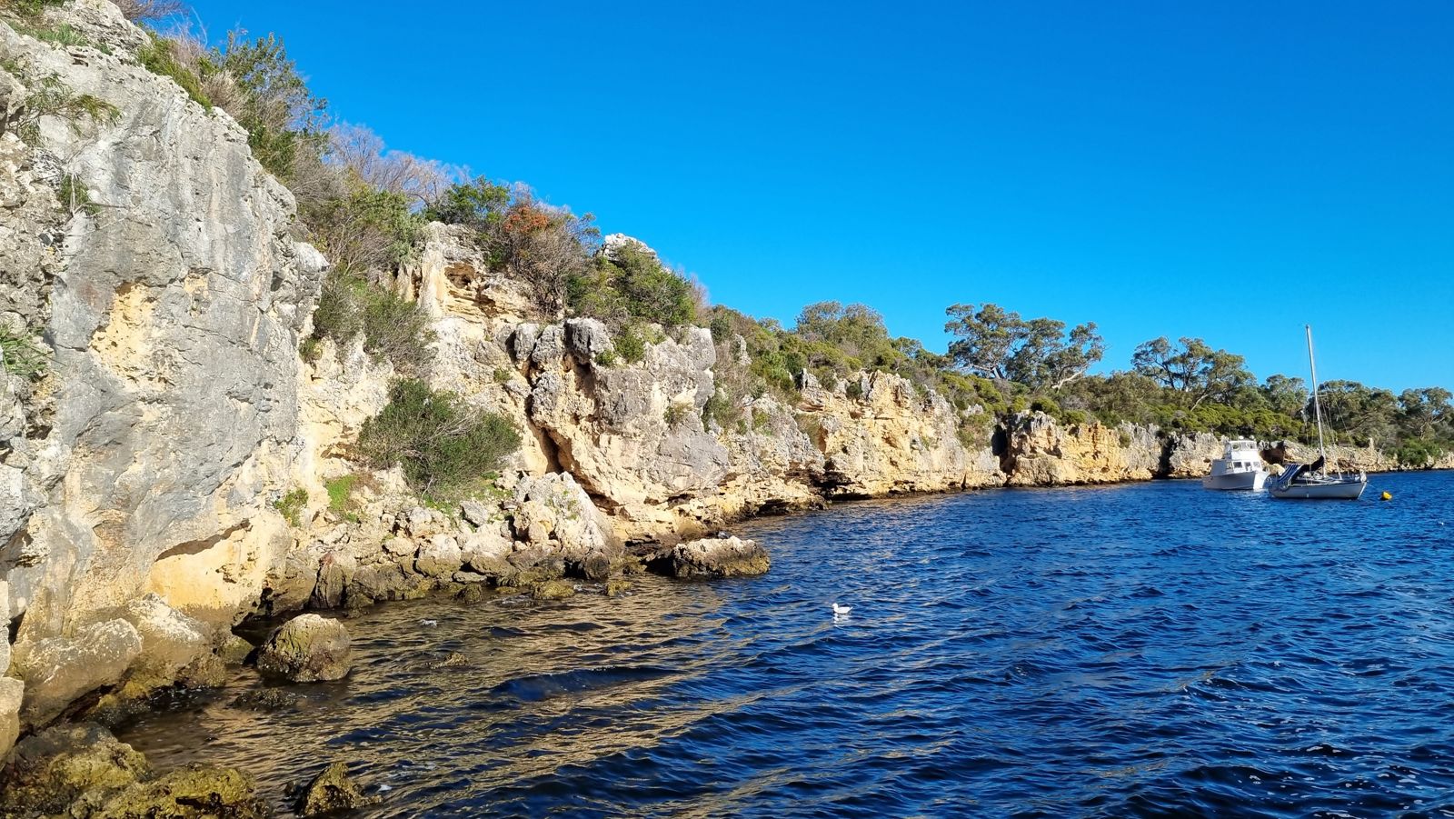 © Sam Wilson
The spot
Community-maintained
Community contribution: submitted by Daniel
Know before you go
Logged by the community, confirmed by mods
Moderate risk: Boat traffic
The Swan River is an active waterway with powerboats and ferries; snorkellers must remain vigilant for vessel traffic.
Moderate risk: Cliff jumpers
People jumping from the 11 m limestone cliffs may land on snorkellers below; stay clear of the cliff base.
Low risk: River current
Tidal outflow from the Swan River can create moderate currents, especially during ebb tides near the narrow channel.
Low risk: Submerged wreck debris
Sharp metal edges, cables, and vehicle wreckage pose cut and entanglement hazards to snorkellers.
Low risk: Water depth changes
Depth drops quickly from the shoreline to over 15 metres; not suitable for weak swimmers or non-swimmers.
Wildlife Guide
No wildlife notes for this spot yet.
Getting in
Shore entry
Entry
Located off Blackwall Reach Parade in Bicton, about 15 km south-west of Perth CBD. Follow Canning Highway to Point Walter Road, then turn onto Blackwall Reach Parade. The reserve is clearly signed and includes a car park at the river's edge.
Parking & facilities
Free car park available at Blackwall Reach Reserve off Blackwall Reach Parade.
parkingpicnic_tables
Free entry. No fees required.
Spot Map
Community
Gallery ┬╖ 3 photos
Trust
Is this spot real, accurate, still loved?
Spots near Western Australia

No nearby spots yet.
Needs verification
Quick verify
One tap helps the community keep this spot honest.
About this data
- Conditions last evaluated
- Spot data last updated
- Data sources
- Open-Meteo (marine & weather conditions), tide predictions via UTide, community contributors (descriptions, hazards, marine life).
- License
- Spot content licensed under CC BY-SA 4.0. How's the Spot is open source.
Weather & swell ┬╖ Open-Meteo marine & weather APIs Tides ┬╖ UTide harmonic analysis Sea & safety ┬╖ community reports