Big Woody Island (Tooliewah), a secluded sand island in the Great Sandy Strait, offers excellent shore-entry snorkeling along its western and northern reefs. A 25-minute boat hop from Urangan Boat Harbour delivers you to pristine beaches like Jefferies Beach and One Tree. Indigenous fish traps are still visible in the shallows, and the surrounding fringing reefs and coral bommies host abundant marine life. The island's rugged summit rewards hikers with panoramic views, while the historic 1866 lighthouse adds a layer of maritime heritage. This is a wild, self-sufficient escape where the snorkeling is best on calm days over shallow reef flats.
Big Woody Island
IntermediateGO
GO
It's a go.
Showing last known conditions
Wave Height 0.0 mSwell Period 2.4 sWind Speed 0.7 knPrecipitation 0.0 mmTidal Phase flood
Last evaluated
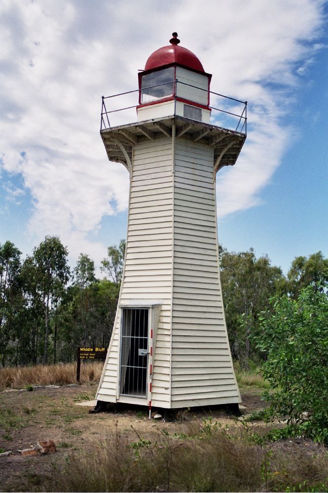 © Heritage branch staff
The spot
Community-maintained
Community contribution: submitted by Daniel
Know before you go
Logged by the community, confirmed by mods
Moderate risk: Strong tidal currents
The Great Sandy Strait experiences significant tidal movement through the narrow channels around Big Woody Island, which can create strong currents, especially on outgoing tides.
Moderate risk: Marine stingers (box jellyfish)
Box jellyfish and other marine stingers may be present in the warmer months (November to May).
Moderate risk: Outgoing tide current
Strong tidal flows through the Great Sandy Strait can create hazardous conditions for swimmers and kayakers, especially when wind opposes tide.
Moderate risk: Boat traffic near marina
The channel between Urangan Marina and Round Island is busy with boats and jet skis; kayakers and swimmers must stay vigilant.
Low risk: Remote island access
No permanent facilities or ranger presence on the island; visitors must be fully self-sufficient and carry communication equipment.
Low risk: Limited landing beaches
Only Jefferies Beach and One Tree are viable landing points; conditions change with tide and wind, making beach landings potentially hazardous.
Low risk: Shallow sandbanks at low tide
Extensive shallow sand banks and narrow passages can be hazardous for boat navigation and may leave snorkelers stranded away from deeper water.
Low risk: Exposed reef at low tide
The reef surrounding Round Island is exposed at low tide, limiting snorkeling access and posing a risk of cuts from sharp coral/crustaceans.
Wildlife Guide
No wildlife notes for this spot yet.
Gallery
1 photo from the community
Getting in
Boat
Entry
Accessible via a 25-minute boat trip from Urangan Boat Harbour in Hervey Bay. Skippered charters and private vessels can land at Jefferies Beach (south-eastern coast) or One Tree (southern side). Tour operators depart from Urangan Boat Harbour and Great Sandy Straits Marina. No public ferry service — you need your own boat or a charter.
Parking & facilities
Free open-air parking is available at Urangan Boat Harbour. The marina does not offer secure/locked parking.
toilets
No entry fee for the island itself. Camping permits from QLD National Parks required for overnight stays. Charter tours from Hervey Bay start around $100 per person.
Spot Map
Community
Gallery ┬╖ 1 photos
Trust
Is this spot real, accurate, still loved?
Spots near Queensland

No nearby spots yet.
Needs verification
Quick verify
One tap helps the community keep this spot honest.
About this data
- Conditions last evaluated
- Spot data last updated
- Data sources
- Open-Meteo (marine & weather conditions), tide predictions via UTide, community contributors (descriptions, hazards, marine life).
- License
- Spot content licensed under CC BY-SA 4.0. How's the Spot is open source.
Weather & swell ┬╖ Open-Meteo marine & weather APIs Tides ┬╖ UTide harmonic analysis Sea & safety ┬╖ community reports