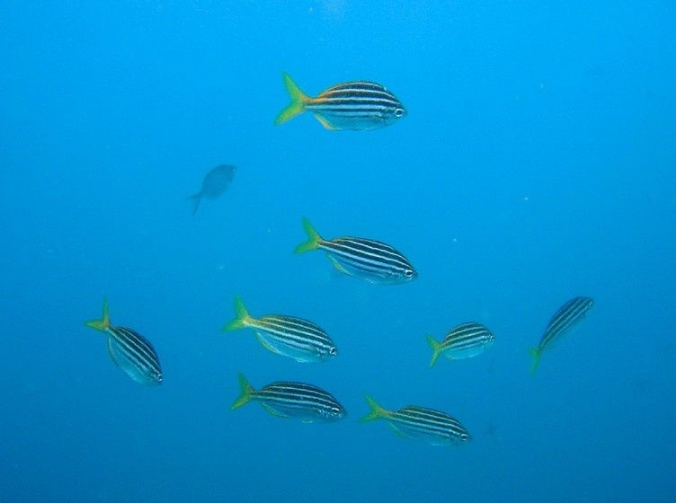
Big Seal Rock is a small, rugged offshore outcrop about 100 m from the beach at Seal Rocks on the NSW Mid North Coast. Accessed only by boat (a short 10-minute run from the shore), this site is world-famous for its grey nurse shark aggregations. The dive site features a series of rocky gutters, boulder fields, and a shallow cave where sharks often shelter. Beyond the sharks, the boulder-strewn bottom is draped with colourful sponges, sea squirts, and small gorgonians, while schools of yellowtail, silver sweep, mado, and leatherjackets drift through the water column. The northern end holds the best shark gutters, with depths ranging from 12 m to 25 m, and a dramatic vertical wall drops away to 35 m on the eastern side.
Big Seal (Seal Rocks dive site)
IntermediateGO
GO
It's a go.
Showing last known conditions
Wave Height 0.8 mSwell Period 8.6 sWind Speed 1.7 knPrecipitation 0.1 mmTidal Phase slack
Last evaluated
 © Richard Ling
DANGER: Explicit Risks Present
Big Seal (Seal Rocks dive site) has hazards marked as danger. Entering the water here means you may face serious risks to your personal safety.
- Large Ocean Swell danger
Exposed location receives significant Southern Ocean swell, creating rough surface conditions and surge around the rocks.
- Depth and decompression risk danger
Snorkelers venturing deep (15-26 m) risk shallow-water blackout; this site is primarily for advanced divers.
- Strong East Australian Current danger
The EAC runs north to south past Little Seal Rock and can sweep snorkellers away from the anchor line. A surface marker buoy is essential.
- Unpatrolled Waters danger
No lifeguard or patrol services at this remote offshore site. Self-reliance and a buddy system are mandatory.
- Depth & Decompression Risk danger
Snorkelling the reef at 15–26 m depth carries significant risk of shallow-water blackout and requires excellent fitness and freediving experience.
- Deep depths (24–35 m) danger
Jimmy's Cave is a deep, fully enclosed cave dive/snorkel site requiring advanced experience; depths range from 24 m at the rubble pile entrance down to 35 m in the main cave.
- Enclosed cave environment danger
The cave is a fully enclosed system with narrow chimney passages and multiple exits — disorientation and entrapment risk without a guide.
The spot
Community-maintained
Community contribution: submitted by Daniel
Know before you go
Logged by the community, confirmed by mods
High risk: Large Ocean Swell
Exposed location receives significant Southern Ocean swell, creating rough surface conditions and surge around the rocks.
High risk: Depth and decompression risk
Snorkelers venturing deep (15-26 m) risk shallow-water blackout; this site is primarily for advanced divers.
High risk: Strong East Australian Current
The EAC runs north to south past Little Seal Rock and can sweep snorkellers away from the anchor line. A surface marker buoy is essential.
High risk: Unpatrolled Waters
No lifeguard or patrol services at this remote offshore site. Self-reliance and a buddy system are mandatory.
High risk: Depth & Decompression Risk
Snorkelling the reef at 15–26 m depth carries significant risk of shallow-water blackout and requires excellent fitness and freediving experience.
High risk: Deep depths (24–35 m)
Jimmy's Cave is a deep, fully enclosed cave dive/snorkel site requiring advanced experience; depths range from 24 m at the rubble pile entrance down to 35 m in the main cave.
High risk: Enclosed cave environment
The cave is a fully enclosed system with narrow chimney passages and multiple exits — disorientation and entrapment risk without a guide.
Moderate risk: Ocean swells and surge around rocks
Swells can push snorkellers onto sharp barnacle-encrusted rocks. Conditions change quickly around the exposed offshore outcrops.
Moderate risk: Strong currents between rocks
Channel currents can develop between the offshore rocks, especially on outgoing tides, making it difficult to swim back to shore.
Moderate risk: Strong currents around rocks
Tidal currents can run strongly between the shore and the outcrop, especially on an outgoing tide. Swimmers need to be aware of drift.
Moderate risk: Unpatrolled beach
Boat Beach and the surrounding area are not patrolled by lifeguards. No safety signage or rescue equipment is available on site.
Moderate risk: Swell / Oceanic Conditions
Lighthouse Beach faces south and is fully open to southerly swells, creating powerful surf and strong rips. Conditions can change rapidly.
Moderate risk: Ocean swell and surge
Exposed offshore reef can experience significant swell and surge, especially in southerly winds.
Moderate risk: Strong tidal currents
Tidal currents around the reef can be strong and unpredictable, particularly during outgoing tides.
Moderate risk: Strong Riptides & Currents
Tidal flows around the islet produce powerful rips and unpredictable currents.
Moderate risk: Depth and sudden drop-offs
Eastern side drops dramatically from 15 m to 35 m; strong descent can disorient inexperienced snorkellers/divers.
Moderate risk: East Australian Current
Strong north-to-south current flowing past the exposed reef, requiring a surface marker buoy and careful navigation.
Moderate risk: Surf and swell conditions
Exposed beaches can experience strong waves and rips, especially when the southerly swell is up. Conditions change quickly.
Moderate risk: Rip currents
Rips are common on the open beaches around Seal Rocks and can be dangerous for inexperienced snorkellers.
Moderate risk: Ocean currents and swell
Exposed to ocean conditions, the area around the rocky outcrop can experience moderate currents and swell, particularly on incoming tides and during southerly winds.
Moderate risk: Ocean swells and rip currents
Lighthouse Beach faces south and is fully exposed to southerly swells; strong rips can develop. Not recommended for inexperienced swimmers.
Moderate risk: Depth changes
The sea floor drops dramatically from 12 m to 25–35 m on the eastern side of the island, which can surprise less experienced snorkellers.
Moderate risk: Strong ocean swells
The eastern side of Big Seal Rock is exposed to open ocean swells, creating potential surge conditions around the island.
Moderate risk: Prevailing Ocean Swell
The exposed offshore location receives the full force of southerly swells, creating challenging conditions on all but the calmest days.
Moderate risk: Strong ocean currents
The Seal Rocks area can experience strong tidal currents and ocean swells, particularly around the offshore islands and cave openings.
Low risk: Marine stingers
Bluebottles and occasional box jellyfish may be present during warmer months.
Low risk: Wobbegong sharks
These well-camouflaged carpet sharks rest on the seafloor among seaweed. Though not aggressive, they can bite if accidentally stepped on or touched.
Low risk: Open ocean swell exposure
The rocky outcrop is exposed to ocean swells, particularly from the south-east. Conditions can change rapidly with rougher seas making snorkelling hazardous.
Low risk: Sharp rocks and barnacles
Entry and exit points around the rocky outcrop have sharp barnacle-covered rocks. Rash vest, booties and care required.
Low risk: Grey nurse shark interaction
While generally docile, grey nurse sharks are a protected species. Snorkellers should maintain a respectful distance and not harass or touch them.
Low risk: Sharp Rocks & Reef
The offshore rocky outcrop and surrounding reef have sharp, barnacle-encrusted edges. Care required when entering and exiting the water.
Low risk: Marine Wildlife (Sharks)
Grey nurse sharks aggregate year-round at this site. While generally docile, their presence demands respect. Also home to wobbegongs and Port Jackson sharks.
Low risk: 4WD Traffic on Beach
Vehicle access for boat launching on Boat Beach means snorkellers need to be aware of vehicles entering and exiting the water.
Low risk: Boat traffic
Popular with dive boats and private vessels — stay vigilant when surfacing.
Low risk: Sharp reef and rock ledges
Sharp barnacle-encrusted rocks at the waterline can cause cuts during entry and exit.
Low risk: Strong currents at Treachery Beach
Treachery Beach and Lighthouse Beach can develop powerful rip currents and surf conditions unsuitable for snorkeling. Stick to Boat Beach for safe conditions.
Low risk: Limited parking at Boat Beach
The small carpark on the headland above Boat Beach fills quickly in peak season and holiday periods, requiring an early arrival or a longer walk.
Low risk: Sharp Barnacle-Covered Rocks
Granite boulders and rocky ledges around the islet are encrusted with sharp barnacles and shellfish.
Low risk: Shark Presence
Seal colony nearby can attract larger sharks in the area.
Low risk: Overhead environment (cave/gutter)
The shark gutter ends in a small cave/overhang; limited overhead clearance and potential silt-out if stirred.
Low risk: Offshore swell exposure
Little Seal Rock is fully exposed to prevailing ocean swells, which can create hazardous surface conditions.
Low risk: Cold water temperature
Water temperatures range 18–24°C, with winter temps as low as 18°C increasing hypothermia risk on long excursions.
Low risk: Rocks and reef
Rocky headlands and shallow reef edges near Boat Beach require care when entering and exiting the water.
Low risk: Limited facilities
Remote location means no lifeguards, limited mobile reception, and no nearby medical facilities.
Low risk: Grey nurse shark presence
While generally docile, grey nurse sharks are a protected species that aggregate around the rocky outcrop. Snorkellers should maintain a respectful distance and avoid sudden movements.
Low risk: Rocky reef terrain
The snorkelling area around the offshore rocks has uneven reef bottoms with kelp and crevices. Snorkellers should wear reef shoes and take care entering and exiting.
Low risk: Rocky outcrops
Sharp rocks and reef surround the snorkelling areas near Statis Island and the main outcrop. Wear reef shoes and watch your footing.
Low risk: Grey nurse sharks
Grey nurse sharks (critically endangered) are the main attraction and may be encountered in gutters and caves; they are generally docile but should be treated with respect and not startled.
Low risk: Funnelled swell in narrow gap
Swell can become problematic in the narrow channel between Status Rock and the headland, especially in southerly conditions.
Low risk: Straying onto open sand
Navigating back to the reef can be difficult if you stray too far onto the sandy bottom away from the rock structure.
Low risk: Low visibility zones
Inside the cave and chimney passages, silt and particulate matter can reduce visibility significantly when stirred up.
Wildlife Guide
No wildlife notes for this spot yet.
Gallery
6 photos from the community
Getting in
Boat
Entry
From Forster, drive 42 km south to Seal Rocks village (35–40 min). Meet dive operators at the beach launch point near the caravan kiosk. The boat ride to Big Seal Rock takes about 10 minutes from the beach.
Parking & facilities
Limited street parking available near the Seal Rocks beach launch area. Arrive early during peak season (summer holidays) as spaces fill quickly.
toiletsparking
No site fee, but access requires booking with a licensed dive operator out of Forster (e.g., Dive Forster or Forster Dive Centre). Boat charter/dive trip fees apply — typically $100–$180 per person.
Spot Map
Community
Gallery ┬╖ 6 photos
Trust
Is this spot real, accurate, still loved?
Spots near New South Wales

No nearby spots yet.
Needs verification
Quick verify
One tap helps the community keep this spot honest.
About this data
- Conditions last evaluated
- Spot data last updated
- Data sources
- Open-Meteo (marine & weather conditions), tide predictions via UTide, community contributors (descriptions, hazards, marine life).
- License
- Spot content licensed under CC BY-SA 4.0. How's the Spot is open source.
Weather & swell ┬╖ Open-Meteo marine & weather APIs Tides ┬╖ UTide harmonic analysis Sea & safety ┬╖ community reports