The historical 1629 shipwreck site of the Dutch East Indiaman Batavia on Morning Reef in the Houtman Abrolhos Islands, 60km offshore from Geraldton. This pristine coral reef offers exceptional snorkeling over a world-famous maritime archaeological site with excellent coral cover.
Batavia Wreck (Abrolhos)
Western Australia Advanced
Hazardous — Do Not Enter The Water.
HighEffective waves 2.6m, wind 45kt, swell 11.5s. Coastal shelter index 0.6×. Confidence: High.
The historical 1629 shipwreck site of the Dutch East Indiaman Batavia on Morning Reef in the Houtman Abrolhos Islands, 60km offshore from Geraldton. This pristine coral reef offers exceptional snorkeling over a…
Today's Conditions
Batavia Wreck (Abrolhos)
Confidence:High (100%)
CSI:0.6×
Waves
2.6m
Wind
45kt
Swell
11.5s
Water Visibility
POORmedium confidence 4/6 signals
Evaluated •••
Tide Chart
No tide data available for this spot.
Hourly Breakdown
Hourly conditions
Excellent Good Fair Poor Hazardous
Best time today: 12:00 AM· Hazardous
3p
6p
9p
12a
3a
6a
9a
12p
| Hour | Score | Waves | Wind | Swell |
|---|---|---|---|---|
| 12:00 AM | Hazardous | 2.7m | 47kt | 12s |
| 1:00 AM | Hazardous | 2.7m | 47kt | 12s |
| 2:00 AM | Hazardous | 2.7m | 47kt | 12s |
| 3:00 AM | Hazardous | 2.7m | 47kt | 12s |
| 4:00 AM | Hazardous | 2.7m | 47kt | 12s |
| 5:00 AM | Hazardous | 2.7m | 47kt | 12s |
| 6:00 AM | Hazardous | 2.7m | 47kt | 12s |
| 7:00 AM | Hazardous | 2.7m | 47kt | 12s |
| 8:00 AM | Hazardous | 2.7m | 47kt | 12s |
| 9:00 AM | Hazardous | 2.7m | 48kt | 12s |
| 10:00 AM | Hazardous | 2.7m | 48kt | 12s |
| 11:00 AM | Hazardous | 2.7m | 50kt | 12s |
| 12:00 PM | Hazardous | 2.6m | 50kt | 12s |
| 1:00 PM | Hazardous | 2.6m | 48kt | 12s |
| 2:00 PM | Hazardous | 2.6m | 45kt | 12s |
| 3:00 PM | Hazardous | 2.6m | 48kt | 11s |
| 4:00 PM | Hazardous | 2.5m | 50kt | 11s |
| 5:00 PM | Hazardous | 2.5m | 49kt | 11s |
| 6:00 PM | Hazardous | 2.5m | 47kt | 11s |
| 7:00 PM | Hazardous | 2.4m | 47kt | 11s |
| 8:00 PM | Hazardous | 2.4m | 45kt | 11s |
| 9:00 PM | Hazardous | 3.9m | 76kt | 11s |
| 10:00 PM | Hazardous | 3.9m | 69kt | 11s |
| 11:00 PM | Hazardous | 3.9m | 76kt | 11s |
7-Day Forecast
Swipe to see all 7 days×
About this spot
Getting There
Directions
Located 60 km offshore from Geraldton; accessible only via authorized commercial charter boat or scenic flight.
Fees
Commercial charter fees apply
Access Method
BoatHazards
- Extreme Isolation danger
Extreme isolation 60km offshore with no emergency facilities.
- High-Velocity Tidal Currents danger
High-velocity tidal currents in the channels.
- Shallow Reef Tops warning
Shallow reef tops pose grounding and injury risk.
- Open Ocean Swells warning
Open ocean swells in unprotected waters.
Difficulty & Marine Life
Marine Life
- Pristine Coral
Pristine coral cover on Morning Reef.
- Reef Fish
Abundant reef fish around the shipwreck site.
Spot Map
Snorkel route guide map for this spot.
Wildlife Guide
May 1 – Jul 31 (any year)
Sea Turtle (1)
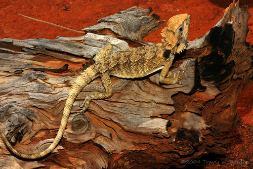
Photo: (c) Travis W. Reeder, some rights reserved (CC BY-NC), uploaded by Travis W. Reeder
LikelySea Turtle
Dwarf Bearded Dragon
Pogona minor
1 recent observation
24 species recorded · Data from iNaturalist
Species data and photos provided by iNaturalist contributors. Individual photo attributions are listed per species. Photos may be licensed under CC-BY-NC.
Spots near Western Australia

No nearby spots yet.
Check back soon — we add new snorkel spots regularly.
Wetsuit Recommendation
22.8°C3mm full wetsuit
Recommended for extended snorkeling sessions
About this data
- Conditions last evaluated
- Spot data last updated
- Data sources
- Open-Meteo (weather & tides), Bureau of Meteorology (sea state), community contributors (descriptions, hazards, marine life).
- License
- Spot content licensed under CC BY-SA 4.0. HowsTheSpot is open source.