Morning Reef in the Wallabi Group of the Houtman Abrolhos Islands is the final resting place of the infamous Dutch East India Company ship Batavia, wrecked in 1629. This shallow coral platform surrounds scattered reef remnants and limestone bommies, offering clear turquoise waters over a reef system rich with tropical fish, staghorn coral, and plate coral. The wreck itself lies fragmented among the coral — iron cannonballs, anchor stocks, and ballast stones are visible in the surge zone. This is a remote, wild site accessible only by boat from Geraldton, prized for its unique blend of maritime history and pristine coral reef snorkeling. The site is exposed to swell and wind, and currents can run strongly over the reef flat.
Batavia Shipwreck (Morning Reef, Abrolhos Islands)
IntermediateGO
GO
It's a go.
Showing last known conditions
Wave Height 0.2 mSwell Period 11 sWind Speed 4.9 knPrecipitation 0.6 mmTidal Phase ebb
Last evaluated
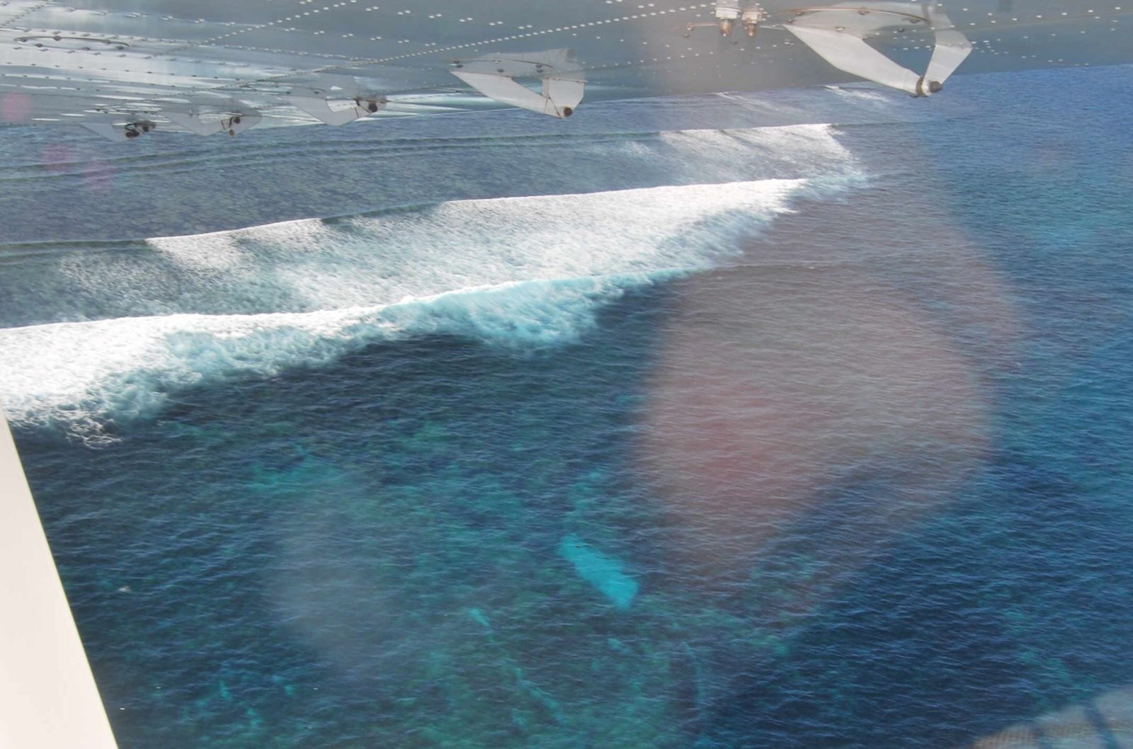 © Guy de la Bedoyere
DANGER: Explicit Risks Present
Batavia Shipwreck (Morning Reef, Abrolhos Islands) has hazards marked as danger. Entering the water here means you may face serious risks to your personal safety.
- Remote location - no immediate emergency services danger
The Abrolhos are 60 km offshore from Geraldton with no medical facilities on the islands; evacuation is by boat or helicopter.
The spot
Community-maintained
Community contribution: submitted by Daniel
Know before you go
Logged by the community, confirmed by mods
High risk: Remote location - no immediate emergency services
The Abrolhos are 60 km offshore from Geraldton with no medical facilities on the islands; evacuation is by boat or helicopter.
Moderate risk: Strong tidal currents over reef flat
Tidal flows across Morning Reef can sweep snorkelers off the reef into deeper water, especially during spring tides.
Moderate risk: Swell and surge exposure
The reef is open to Indian Ocean swells; breaking waves on the reef crest create hazardous surge zones over sharp coral.
Moderate risk: Marine stinger season
Box jellyfish and Irukandji are present in warmer months from November to May.
Moderate risk: Swell and wind exposure
The site is on the windward side of Morning Reef and exposed to ocean swell, requiring calm conditions for safe snorkeling.
Moderate risk: Tidal currents
Strong tidal currents sweep across Morning Reef, especially during incoming and outgoing tides.
Moderate risk: Sharp coral and wreck debris
Morning Reef has sharp coral formations and the wreck's broken hull, cannons, and anchors pose cuts and entanglement risks.
Moderate risk: Strong ocean currents
The open Indian Ocean can produce unpredictable currents around the reef shelf, especially during tidal changes.
Low risk: Sharp coral and limestone bommies
The reef pavement is studded with jagged coral bommies and encrusted with barnacles — cuts and abrasions are common.
Low risk: Sharp reef / coral
Sharp coral and reef structures surround the wreck site, posing cut and abrasion risk.
Low risk: Remote location
The remote island location means emergency medical assistance is hours away; snorkel with a guided tour operator.
Low risk: Marine stingers
Box jellyfish and other stingers can be present in warmer months (November to April).
Wildlife Guide
No wildlife notes for this spot yet.
Gallery
3 photos from the community
Getting in
Boat
Entry
The Batavia wreck site on Morning Reef lies in the Wallabi Group of the Houtman Abrolhos Islands, approximately 60 km west of Geraldton, Western Australia. Access is exclusively by boat — either a chartered tour from Geraldton or private vessel. The closest mooring is at Beacon Island (nearby). Most visitors join full-day snorkel tours operated by Abrolhos Adventures or Geraldton-based charter companies that include the shipwreck site on their reef itineraries.
Parking & facilities
Park at the Geraldton Fishermen's Harbour or Batavia Coast Marina car parks if driving to the charter departure point. Both are free public parking areas.
toilets
Charter costs approx. AUD $200–$300 per person for a full-day Abrolhos tour including snorkel gear, lunch, and park fees. No fee for the wreck site itself.
Spot Map
Community
Gallery ┬╖ 3 photos
Trust
Is this spot real, accurate, still loved?
Spots near Western Australia

No nearby spots yet.
Needs verification
Quick verify
One tap helps the community keep this spot honest.
About this data
- Conditions last evaluated
- Spot data last updated
- Data sources
- Open-Meteo (marine & weather conditions), tide predictions via UTide, community contributors (descriptions, hazards, marine life).
- License
- Spot content licensed under CC BY-SA 4.0. How's the Spot is open source.
Weather & swell ┬╖ Open-Meteo marine & weather APIs Tides ┬╖ UTide harmonic analysis Sea & safety ┬╖ community reports