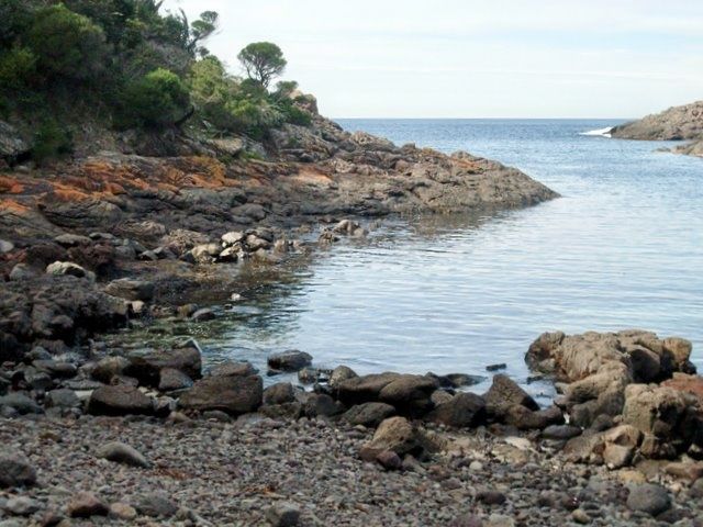
Bass Point Reserve, just south of Shellharbour on the NSW South Coast, is a premier snorkeling destination centred on Bushrangers Bay — a protected Aquatic Reserve. The headland shelters a rocky embayment with crystal-clear waters, underwater cliffs, and the remains of shipwrecks just offshore. Sheltered from prevailing winds, the bay offers calm, clear conditions ideal for spotting abundant marine life amid boulders and kelp gardens. The reserve also features a coastal walking track with panoramic ocean views, making it a favourite for nature lovers above and below the water.
Bass Point Reserve
BeginnerGO
GO
It's a go.
Showing last known conditions
Wave Height 0.3 mSwell Period 6.5 sWind Speed 1.6 knPrecipitation 16 mmTidal Phase slack
Last evaluated
The spot
Community-maintained
Community contribution: submitted by Daniel
Know before you go
Logged by the community, confirmed by mods
Low risk: Boat traffic
Bass Point is a popular dive site with boat traffic entering the bay; stay aware of vessels.
Low risk: Rocks and submerged boulders
The bay has a rocky shoreline and submerged boulders; watch for sharp edges when entering and exiting.
Low risk: Swell surges
During southerly swells, surge conditions can develop around the rocky headland.
Wildlife Guide
No wildlife notes for this spot yet.
Gallery
4 photos from the community
Getting in
Shore entry
Entry
Bass Point Reserve is located at the end of Bass Point Tourist Road, Shell Cove, approximately 4 km south of Shellharbour and about 20 minutes' drive south of Wollongong via the M1. Follow the signs to Bass Point Reserve from Shellharbour Road.
Parking & facilities
Car park available at the reserve, with spaces for cars and small trailers. The parking area is a short walk from Bushrangers Bay.
toiletsparkingpicnic_tables
Free entry. No fees required for snorkeling access.
Spot Map
Community
Gallery ┬╖ 4 photos
Trust
Is this spot real, accurate, still loved?
Spots near New South Wales

No nearby spots yet.
Needs verification
Quick verify
One tap helps the community keep this spot honest.
About this data
- Conditions last evaluated
- Spot data last updated
- Data sources
- Open-Meteo (marine & weather conditions), tide predictions via UTide, community contributors (descriptions, hazards, marine life).
- License
- Spot content licensed under CC BY-SA 4.0. How's the Spot is open source.
Weather & swell ┬╖ Open-Meteo marine & weather APIs Tides ┬╖ UTide harmonic analysis Sea & safety ┬╖ community reports