Barred Creek is a stunning tidal creek on the Dampier Peninsula, about 60 km north of Broome, where crystal-clear aqua waters spill across white sandy beaches and flood a wide tidal flat at high tide. The creek mouth opens to the turquoise Indian Ocean, creating a shallow, sandy snorkeling zone that transforms dramatically with the tides. Backed by dunes and fringed with mangroves, this remote Kimberley gem offers an untouched, wild beauty — but requires a 4WD to reach and serious caution due to resident saltwater crocodiles.
Barred Creek
AdvancedGO
GO
It's a go.
Showing last known conditions
Wave Height 0.5 mSwell Period 3.1 sWind Speed 4.7 knPrecipitation 0.1 mmTidal Phase flood
Last evaluated
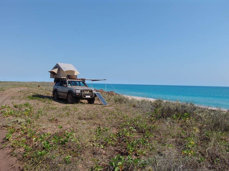 © Uneekwahn at English Wikipedia
DANGER: Explicit Risks Present
Barred Creek has hazards marked as danger. Entering the water here means you may face serious risks to your personal safety.
- Saltwater Crocodiles danger
A resident saltwater crocodile is known to inhabit the creek. Crocodiles are present year-round and have been involved in attacks at this location. Do not enter the water.
The spot
Community-maintained
Community contribution: submitted by Daniel
Know before you go
Logged by the community, confirmed by mods
High risk: Saltwater Crocodiles
A resident saltwater crocodile is known to inhabit the creek. Crocodiles are present year-round and have been involved in attacks at this location. Do not enter the water.
Moderate risk: Strong Tidal Currents
Barred Creek experiences strong tidal movements as the creek fills and drains, creating powerful currents especially around the mouth during tidal changes.
Low risk: Marine Stingers
Jellyfish and stingrays inhabit the waters, with increased risk during warmer months.
Low risk: Sand Flies
Sand flies are prevalent near the mangrove fringe, particularly around the northern part of the creek beach.
Low risk: Sharks
Sharks are known to inhabit the waters off the Dampier Peninsula, including the creek mouth and adjacent beach areas.
Wildlife Guide
No wildlife notes for this spot yet.
Gallery
1 photo from the community
Getting in
Shore entry
Entry
From Broome, head north on Cape Leveque Road (sealed bitumen). Turn onto Minala Road (unsealed, sandy/corrugated) and follow signs to Barred Creek. The final track to the beach is soft sand — 4WD essential. The drive from the sealed road to the creek takes about 15 minutes.
Parking & facilities
Unmarked beach and dune parking along the foreshore. No formal lot — soft sand requires a 4WD with low-range.
Free access. No fees required.
Spot Map
Community
Gallery ┬╖ 1 photos
Trust
Is this spot real, accurate, still loved?
Spots near Western Australia

No nearby spots yet.
Needs verification
Quick verify
One tap helps the community keep this spot honest.
About this data
- Conditions last evaluated
- Spot data last updated
- Data sources
- Open-Meteo (marine & weather conditions), tide predictions via UTide, community contributors (descriptions, hazards, marine life).
- License
- Spot content licensed under CC BY-SA 4.0. How's the Spot is open source.
Weather & swell ┬╖ Open-Meteo marine & weather APIs Tides ┬╖ UTide harmonic analysis Sea & safety ┬╖ community reports