Bare Island, linked by a wooden bridge to La Perouse in Kamay Botany Bay National Park, is Sydney's most popular dive and snorkel destination. The historic 1880s fort sits atop a small island where shallow rocky reefs, sponge gardens, and sandy gutters surround the shore. Snorkellers can explore either side of the island depending on conditions — the eastern side offers clearer water and easy reef navigation, while the calmer western side shelters abundant marine life. The island's protected lee makes it one of Sydney's calmest snorkelling spots, perfect for drifting above colourful sponge gardens and watching for blue gropers, Port Jackson sharks, and weedy sea dragons.
Bare Island
IntermediateGO
GO
It's a go.
Showing last known conditions
Wave Height 0.1 mSwell Period 6.5 sWind Speed 1.5 knPrecipitation 7.6 mmTidal Phase flood
Last evaluated
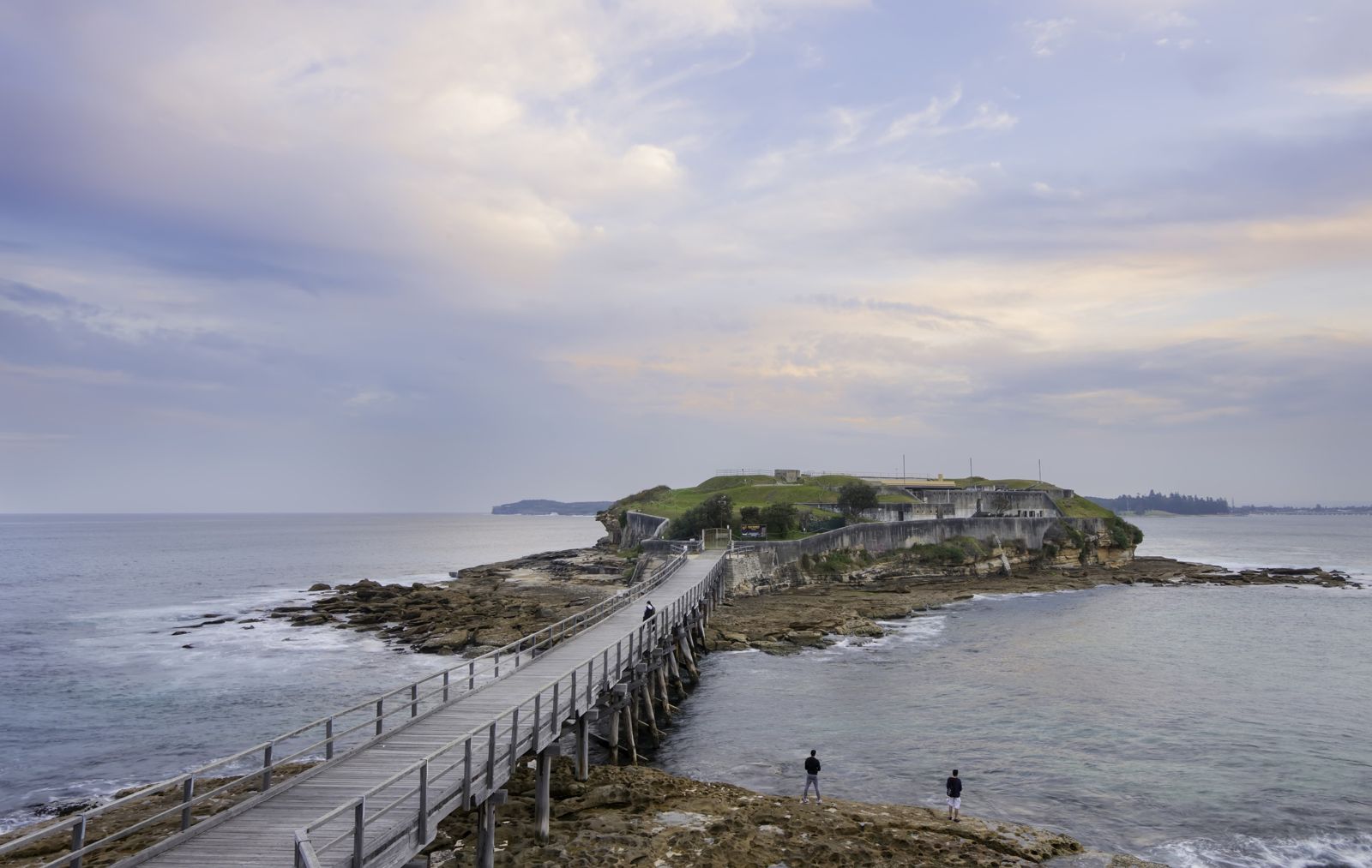 © Lenny K Photography
DANGER: Explicit Risks Present
Bare Island has hazards marked as danger. Entering the water here means you may face serious risks to your personal safety.
- Blue-ringed octopus danger
These small but highly venomous octopus are regularly sighted in rocky crevices from 3–12m. Never touch or provoke. Their venom can cause respiratory failure.
The spot
Community-maintained
Community contribution: submitted by Daniel
Know before you go
Logged by the community, confirmed by mods
High risk: Blue-ringed octopus
These small but highly venomous octopus are regularly sighted in rocky crevices from 3–12m. Never touch or provoke. Their venom can cause respiratory failure.
Moderate risk: Southerly swell
Southerly swells over 1.2m make conditions dangerous, especially on the exposed eastern side. Check the forecast before entering.
Moderate risk: Poor Visibility After Rain
Heavy rain (over 20mm) flushes the Cooks River into Botany Bay, dropping visibility to 1-2m. Avoid snorkeling within 24 hours of significant rainfall.
Moderate risk: Tidal currents across northern passages
Strong tidal flow runs across the northern wall of the island; divers can be swept around the point. Slack water 1–2 hours either side of high tide is safest.
Moderate risk: Southerly swell and surge at entry/exit
The western concrete stairs can become treacherous in southerly swell. Surge can knock divers against the steps. Best to enter/exit on the peak of a surge.
Moderate risk: Boat traffic in Botany Bay
Boat traffic passes close to the island. All divers must carry a surface marker buoy (SMB) for ascent safety.
Moderate risk: Tidal currents
Moderate tidal currents flow around the island, especially during incoming/outgoing tides. Snorkelers should be mindful of being swept past the entry point.
Low risk: Rough entry/exit rocks
Rocky entry points, especially the path beside the wooden bridge and the boat ramp, can be slippery and uneven. Exits can be rough in surge.
Low risk: Outgoing tide current
Flowing tide around the island can create currents, particularly around the eastern and western points. Incoming tide offers calmest conditions.
Low risk: Boat traffic
The boat ramp on the island and nearby boating channel in Botany Bay can have vessel traffic. Stay alert near entry points.
Low risk: Fishing lines from bridge
Fishermen frequently cast lines from the bridge connecting Bare Island to the mainland. Entanglement risk in the inner channel.
Low risk: Boat traffic in channel
The inner channel between the island and mainland is used by small boats and kayaks. Snorkelers should stay close to the rocky shoreline.
Low risk: Limited shade
No shade on the shore or in the water. High sun exposure risk on clear days, especially during warmer months.
Low risk: Strong Currents
Tidal currents can develop in the channel around the island, especially on outgoing tides near the bridge and deeper drop-offs.
Low risk: Fishing Lines
Fishing lines and hooks are occasionally tangled in shallow corals near the shore entry point.
Low risk: Reduced visibility after rain
The nearby Cooks River discharges into Botany Bay, dropping visibility to 3–5m after heavy rain (above 20mm in catchment). Avoid diving within 24 hours.
Low risk: Variable visibility
Visibility swings dramatically from 2m to 20m depending on weather, tides, and recent rain. Poor vis can disorient snorkelers.
Wildlife Guide
No wildlife notes for this spot yet.
Gallery
7 photos from the community
Getting in
Shore entry
Entry
From Sydney CBD, take Anzac Parade south-east to La Perouse. At the roundabout at the end of Anzac Parade, continue straight into Cann Park. Park in the large car park at the southern end of Cann Park, then walk across the wooden footbridge to Bare Island. Snorkel entry is from the boat ramp on the island (right of the bridge) or via the rocky path on the La Perouse side just before the bridge.
Parking & facilities
Free ample parking available at Cann Park (Anzac Parade, La Perouse), including accessible parking bays. Gets very busy on weekends and public holidays — arrive early.
toiletsparkingpicnic_tablesshowers
No fee for snorkeling access. Guided tours of the historic fort require a paid ticket. Snorkel gear rental available nearby for approximately $20/set.
Spot Map
Community
Gallery ┬╖ 7 photos
Trust
Is this spot real, accurate, still loved?
Spots near New South Wales

No nearby spots yet.
Needs verification
Quick verify
One tap helps the community keep this spot honest.
About this data
- Conditions last evaluated
- Spot data last updated
- Data sources
- Open-Meteo (marine & weather conditions), tide predictions via UTide, community contributors (descriptions, hazards, marine life).
- License
- Spot content licensed under CC BY-SA 4.0. How's the Spot is open source.
Weather & swell ┬╖ Open-Meteo marine & weather APIs Tides ┬╖ UTide harmonic analysis Sea & safety ┬╖ community reports