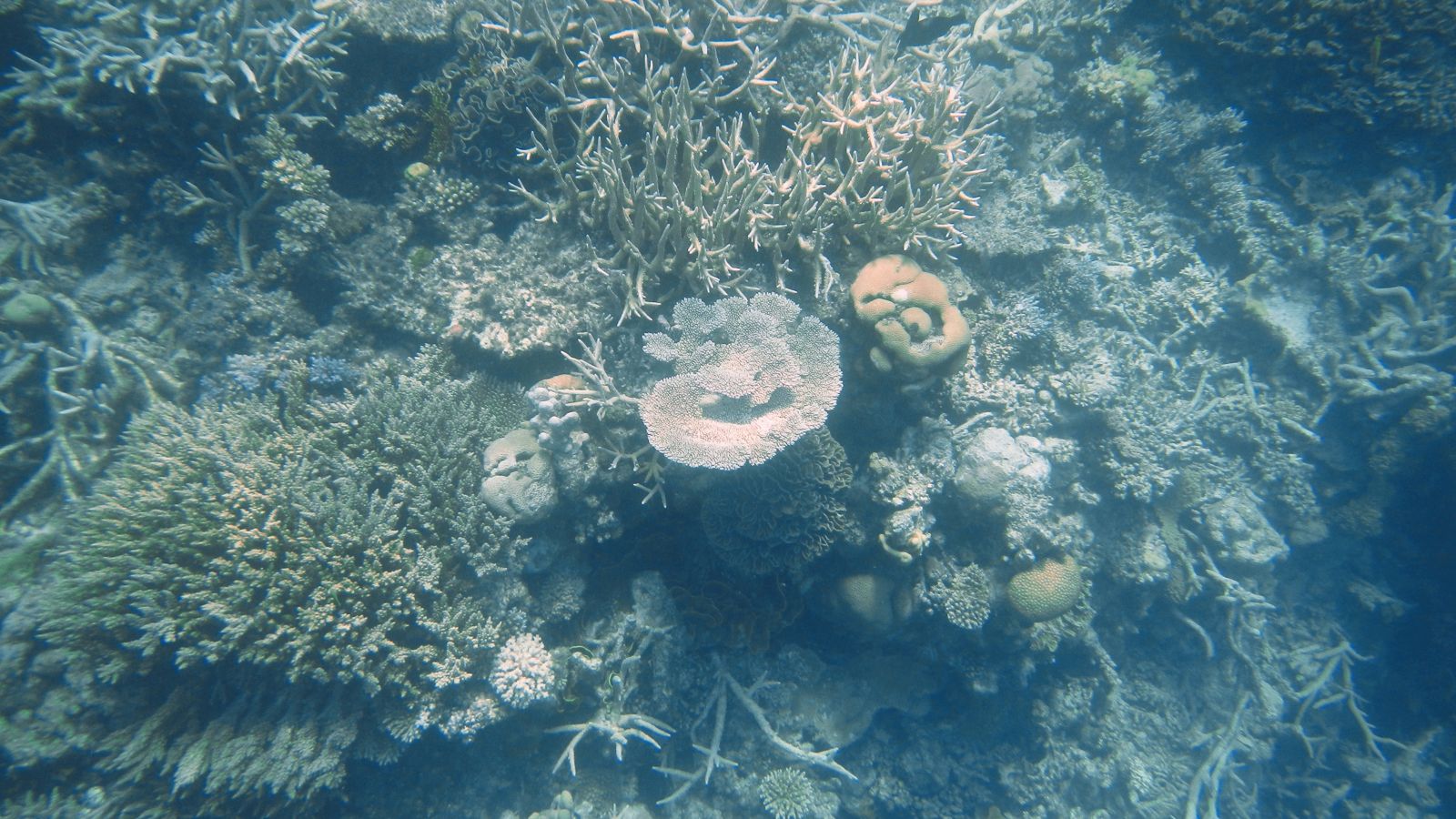
Agincourt Reef is a spectacular ribbon reef system on the outer edge of the Great Barrier Reef, 72 km off Port Douglas in North Queensland. Unlike platform reefs closer to shore, these ribbon reefs rise steeply from deep Coral Sea waters, creating a dramatic split: sheltered inner lagoons with coral gardens on one side and a vertical wall plunging into the open ocean on the other. Constantly flushed by pristine oceanic currents, the water clarity regularly exceeds 20 metres, making it one of the best snorkelling destinations in the world. The reef system comprises multiple smaller ribbon reefs running parallel to the continental shelf, offering diverse terrain from shallow coral gardens to bommies, channels, and swim-throughs.
Agincourt Reef
BeginnerGO
GO
It's a go.
Showing last known conditions
Wave Height 0.2 mSwell Period 6.3 sWind Speed 8.1 knPrecipitation 4.2 mmTidal Phase flood
Last evaluated
The spot
Community-maintained
Community contribution: submitted by Daniel
Know before you go
Logged by the community, confirmed by mods
Moderate risk: Strong tidal currents
The outer reef experiences strong tidal flows that can sweep snorkellers away from the pontoon or group. Always stay within marked snorkel boundaries.
Moderate risk: Marine stingers (box jellyfish / Irukandji)
Marine stingers (box jellyfish and Irukandji) are present in tropical Queensland waters, particularly during the warmer months (October to May).
Moderate risk: Outer wall drop-off and currents
The outer reef wall drops into deep open water with strong currents. Snorkellers are advised to stay within the roped-off swimming areas and heed crew instructions.
Low risk: Open Ocean Crossing (Seasickness)
The 90-minute open-water catamaran crossing from Port Douglas can be rough for those prone to seasickness, especially in windy conditions. Motion sickness medication is strongly recommended.
Low risk: Marine Stingers (Jellyfish)
Stinger season brings box jellyfish and other marine stingers to tropical Queensland waters from October to May. Reef tours provide stinger suits and are included in the trip.
Low risk: Outer Reef Wall Drop-off & Currents
The outer reef wall drops steeply into deep Coral Sea water. Strong tidal currents can occur through channels between ribbon reefs, particularly on the outer wall side.
Low risk: Intense Tropical Sun Exposure
Tropical sun exposure is intense year-round. Reflection off the water increases UV risk. Reef-safe sunscreen, hats, and rash guards are essential.
Low risk: Open ocean swell and wind chop
The reef is open ocean with no land shelter; wind and swell conditions can create choppy surface conditions, especially in the afternoon.
Low risk: Sharp coral and reef cuts
Sharp coral bommies and shallow reef flats can cause cuts and scrapes if swimmers make contact.
Low risk: Seasickness (open ocean crossing)
The boat journey to the outer reef takes 90 minutes across open ocean. Swells and wind can cause seasickness, particularly during the trade wind season.
Low risk: Sharp coral cuts
Coral is sharp and fragile. Snorkellers must avoid touching the reef to prevent injury and protect the ecosystem. Cuts from coral can become infected.
Low risk: Tidal currents
Strong currents can develop along the reef edge, especially on the ocean-facing side of the ribbon reef during tidal changes.
Low risk: Sharp coral
Sharp coral formations and shallow bommies can cause cuts and scrapes if snorkelers make contact.
Low risk: Extreme sun exposure
Sun exposure is intense on the open-water pontoon; reflected UV from the water increases risk of burn.
Wildlife Guide
No wildlife notes for this spot yet.
Gallery
3 photos from the community
Getting in
Snorkel tour
Entry
Agincourt Reef is located 72 km northeast of Port Douglas. Tours depart from Port Douglas Marina via high-speed catamaran (90-minute journey). The closest major airport is Cairns (1 hour drive from Port Douglas).
Parking & facilities
Free parking available at Port Douglas Marina for day visitors joining reef tours. Arrive early as spaces fill quickly during peak season (June–September). Parking is available at the Crystalbrook Superyacht Marina and surrounding public lots in Port Douglas.
Spot Map
Community
Gallery ┬╖ 3 photos
Trust
Is this spot real, accurate, still loved?
Spots near Queensland

No nearby spots yet.
Needs verification
Quick verify
One tap helps the community keep this spot honest.
About this data
- Conditions last evaluated
- Spot data last updated
- Data sources
- Open-Meteo (marine & weather conditions), tide predictions via UTide, community contributors (descriptions, hazards, marine life).
- License
- Spot content licensed under CC BY-SA 4.0. How's the Spot is open source.
Weather & swell ┬╖ Open-Meteo marine & weather APIs Tides ┬╖ UTide harmonic analysis Sea & safety ┬╖ community reports